Introduction
The Bhrigu Lake trek gets you above 4,000 m in three walking days from Manali. That is the whole pitch, and it is a good one. Most Indian treks that reach that altitude ask for a week. This one asks for a long weekend plus travel.
The lake sits east of Rohtang Pass in Kullu district, in a bowl of scree and snow, and it is often still part-frozen when the season opens. What makes the trek unusual is that you hit open meadow on day one. On most Himalayan grassland treks you spend two days in forest before the trees give up. Here they give up almost immediately, and you walk on rolling grass with the Dhauladhar and Pir Panjal in view for the rest of the trek.
It is also the trek where people underestimate the altitude gain and pay for it. Read the acclimatisation section properly.
Table of Contents
- Quick Overview
- The Difficulty Argument
- How to Reach Bhrigu Lake from Mumbai
- How to Reach Bhrigu Lake from Pune
- The Route: Gulaba to the Lake
- The Vashisht Alternative
- Permits: What the Rohtang Rules Actually Say
- Itinerary
- Accommodation
- Food
- Nearby Attractions
- Budget Breakdown
- Practical Tips
- Safety Tips (including AMS)
- Common Mistakes
- Best Time to Visit
- FAQ
Quick Overview
| Item | Detail |
|---|---|
| Location | Kullu district, Himachal Pradesh, east of Rohtang Pass |
| Base | Gulaba, on the Manali–Rohtang road |
| Altitude of lake | 4,300 m per HPTDC; 14,009 ft (approx. 4,270 m) per Indiahikes |
| Distance from Gulaba | HPTDC says around 6 km; Indiahikes documents the full trek as roughly 22 km |
| Duration | 4 days per HPTDC; 3–4 walking days in practice |
| Difficulty | HPTDC grades it "Easy". Indiahikes grades it moderate. Treat it as moderate. |
| Best season | HPTDC lists April to November |
| Gulaba distance from Manali | 24 km |
Where the sources disagree, and how to read it. HPTDC's official trek listing puts the lake at 4,300 m and calls it easy with a four-day duration. Indiahikes documents the highest point at 14,009 ft, which converts to roughly 4,270 m, and grades it moderate. HPTDC's "6 km from Gulaba village" is a straight-line-ish approach distance; the actual walking distance across four days is much more.
Both altitude figures land within thirty metres of each other, which for a Himalayan lake is close enough. Use "approximately 4,270–4,300 m."
The difficulty grading is where I will take a side. HPTDC's own trek page grades Bhrigu Lake as easy. Indiahikes points out that you gain roughly 5,480 ft over just two days of walking, starting from 8,530 ft at Gulaba. That is a serious rate of ascent. Plan it as a moderate trek. The state tourism corporation's grading system is coarse and it will get a sea-level trekker into trouble here.
The Difficulty Argument
There is a real reason Bhrigu Lake feels easier than it is. The trail is not technical. There is no exposure, no rope work, no scrambling that would worry a Sahyadri regular. The path across the meadows is wide and forgiving.
What makes it hard is the vertical, compressed into very little time. From Gulaba at 8,530 ft you climb to Jonker Thatch at around 10,285 ft, then to Rola Kholi at around 12,950 ft, then push to 14,009 ft on summit day and come back down the same day. That last day is a 10 km round trip with about 1,000 ft of gain at an altitude where 1,000 ft feels like three times that.
The final push beyond Rola Kholi is scree and loose ground, and if there is old snow on it, it slows to a crawl.
Indiahikes describes it as well within reach for fit beginners with the right preparation. I would agree with the "fit" and stress the "preparation." If your last big walk was Kalsubai, you can do this. If your last big walk was six months ago, do not.
How to Reach Bhrigu Lake from Mumbai
Everything starts at Manali. Gulaba is 24 km up the Rohtang road from there.
By air to Bhuntar (Kullu–Manali Airport, KUU). Closest airport, roughly 50 km south of Manali. Flights are small, expensive, weather-dependent and route via Delhi. The Kullu valley traps cloud and this runway cancels often. It is the fastest option when it works.
By air to Chandigarh, then road. The dependable choice. Mumbai to Chandigarh direct is about three hours. Chandigarh to Manali is roughly 300 km and takes eight to ten hours depending on traffic on the Kiratpur–Manali stretch. HRTC and private Volvos run this route through the day and overnight.
By air to Delhi, then overnight Volvo. Delhi to Manali is the classic overnight bus and there are dozens of departures from Kashmere Gate and the private operators around Majnu ka Tilla. Twelve to fourteen hours. Cheap, and you wake up in Manali.
By train. There is no railhead near Manali. Chandigarh is the practical rail terminus for this trip; Joginder Nagar's narrow-gauge line is romantic and useless for reaching Manali quickly. Mumbai to Chandigarh by train takes well over a day. Fly.
Manali to Gulaba. Taxi from the Manali taxi stand, about 45 minutes to an hour depending on Rohtang-road traffic. Organised trek operators run shared transfers. Indiahikes, for reference, prices its Manali–Gulaba transfer at ₹900 per trekker one way, which gives you a sense of the going rate.
How to Reach Bhrigu Lake from Pune
Pune → Chandigarh → Manali. Direct Pune–Chandigarh flights run most days. This is the cleanest route and avoids Delhi entirely. Land in Chandigarh, bus or taxi to Manali the same day if you land in the morning, otherwise overnight in Chandigarh.
Pune → Delhi → Manali. Fly to Delhi, take the overnight Volvo. Adds a night but is usually the cheapest total.
Pune → Bhuntar via Delhi. Only if you are short on days and willing to eat the cancellation risk.
Build in a Manali night either way. You need it for acclimatisation, not just logistics.
The Route: Gulaba to the Lake
Gulaba (approx. 8,530 ft). A roadside settlement on the Manali–Rohtang highway, 24 km from Manali. There is not much here. You get out of the vehicle and start walking almost immediately.
Gulaba to Jonker Thatch (approx. 10,285 ft). The climb out of Gulaba is the first steep section and it comes before you are warmed up. Pace it. The trees thin fast and then the meadows open out. Shepherd huts, grazing flocks, and on a clear day the Dhauladhar wall to the west.
Jonker Thatch to Rola Kholi (approx. 12,950 ft). Roughly 5 km, three to four hours. This is the day where you feel the altitude arrive. Rola Kholi is a grazing ground beside a stream at the base of the climb to the lake, and it is one of the better campsites in Himachal — open, water on hand, and the whole Pir Panjal skyline on show at sunset.
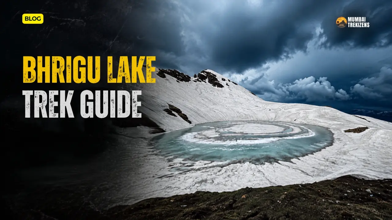
Rola Kholi to Bhrigu Lake and back (approx. 14,009 ft). Roughly 10 km round trip, five to six hours. Scree and boulder ground on the final approach. Snow lingers here well into summer. The lake itself is small, turquoise, and often half-frozen in early season.
Rola Kholi back to Gulaba. Roughly 5 km, three to four hours down. Knees, not lungs, are the issue on this day.
Indiahikes documents the total at around 22 km over four days. HPTDC's four-day framing matches.
The Vashisht Alternative
Vashisht is a village just across the Beas from Manali, known for its hot springs and its temples, and it is sometimes used as an alternative starting point for Bhrigu Lake. The Vashisht approach is longer and gains altitude more gradually, which is a genuine advantage for acclimatisation.
I could not find this route documented on an official Himachal government or HPTDC page. HPTDC's own Bhrigu Lake listing gives the route as Manali–Gulaba–Rola Khuli–Bhrigu Lake and nothing else. Treat the Vashisht start as an operator-run variant rather than the standard line, and ask any operator offering it exactly where they camp and how many days they take.
If your priority is acclimatising properly rather than finishing fast, it is worth asking about.
Permits: What the Rohtang Rules Actually Say
This is where most Bhrigu Lake write-ups get muddled, so let us be precise about what the official portal says.
Permits for the Rohtang axis are issued at rohtangpermits.hp.gov.in, run by the District Administration Kullu and developed by NIC Himachal Pradesh. The portal has three separate sections: Rohtang Pass, Special Rohtang Pass, and Hamta Pass.
The Rohtang tourism permit. Required for vehicles going to Rohtang Pass for tourism. Per the portal:
- Daily quota set under National Green Tribunal / district administration direction: 800 petrol vehicles and 400 diesel vehicles.
- Released online in two windows: 10:00 hrs (400 petrol, 200 diesel) and 16:00 hrs (400 petrol, 200 diesel).
- Only 3 permits per vehicle per week (Tuesday to Monday).
- Vehicle must be under 10 years old, with valid PUC and ID proof.
- Permit is valid for one day only, to and fro.
- A printout is compulsory. No printout, no crossing the barrier.
- Fees: Car/Jeep and MUV — ₹500 permit fee plus ₹50 congestion charge. Buses and HMVs — ₹500 plus ₹100.
- At the time of writing the portal lists no weekly maintenance closure day for Rohtang.
The congestion charge. The portal states this "is applicable for all vehicles crossing Gulaba Bridge." That wording is the key to the whole question.
So do you need a Rohtang permit for the Bhrigu Lake trek?
Based on the portal's own wording: the Rohtang tourism permit governs vehicles going up to Rohtang, and the congestion charge attaches to crossing Gulaba Bridge. A vehicle that drops you at Gulaba and turns around has not gone to Rohtang and has not crossed the bridge. On that reading, you do not need the Rohtang tourism permit to reach the Gulaba trailhead.
I am stating the reasoning rather than a bare yes/no because I could not find an official page that addresses the Bhrigu Lake trek specifically. Two practical steps: confirm with your taxi driver, who deals with the Gulaba barrier daily, and if you are self-driving, ask at the SDM Manali office or the tourism information counter in Manali the day before.
Is there a separate permit for the trek itself?
No official Himachal government source that I could find lists a trekking permit for Bhrigu Lake. HPTDC's trek listing mentions none. That is different from saying none exists — Himachal has been tightening trekking regulation across districts, and Kangra now requires compulsory trekker registration at check posts. Kullu has been setting up check posts on the Kheerganga route for the same reason. Ask your operator, and if you are going independently, ask at the Manali tourism office.
Adventure operators. Himachal registers adventure tour operators under the HP Miscellaneous Adventure Activities Rules, 2021. Use a registered one. It matters for rescue and for insurance.
Itinerary
Day 0 — Arrive Manali. Sleep at roughly 2,000 m. Non-negotiable. Walk around Old Manali, eat, hydrate.
Day 1 — Manali to Gulaba, trek to Jonker Thatch. Drive 24 km, walk up through the last of the trees into open meadow. Camp around 10,285 ft.
Day 2 — Jonker Thatch to Rola Kholi. About 5 km, three to four hours. Camp at roughly 12,950 ft beside the stream.
Day 3 — Rola Kholi to Bhrigu Lake and back. About 10 km round trip, five to six hours. Highest point roughly 14,009 ft. Return to Rola Kholi to sleep.
Day 4 — Rola Kholi to Gulaba, drive to Manali. About 5 km down, three to four hours, then the road.
Some operators compress this into three days by skipping Jonker Thatch and camping directly at Rola Kholi. That is a 4,400 ft gain on day one. Do not do the three-day version if this is your first trek above 4,000 m. The extra night is the difference between a good trek and a headache at 12,950 ft with nowhere to go.
Accommodation
On the trek: tents only. There are no huts, no dhabas and no rest houses between Gulaba and the lake. Whatever your operator carries is what you get. Rola Kholi and Jonker Thatch are the standard campsites.
In Manali: everything from ₹700 hostel beds in Old Manali to serious hotels in Manali town and Aleo. Old Manali is better for trekkers — cheaper, quieter, and the gear shops are there.
In Vashisht: hot springs, guesthouses, and a slightly slower pace than Old Manali. Good place for the recovery night after.
HPTDC properties in Manali can be booked through the corporation's own portal and are usually decent value.
Food
Carry everything above Gulaba. There are no shops, no chai stalls, nothing. Shepherds are up there in season but they are not a food supply.
Trek operators run a kitchen and feed you three meals plus tea. Independent trekkers need to carry a stove, fuel and food for four days plus a spare day. That weight is a real factor on a 5,480 ft climb.
What to add to your own pack regardless of who is cooking: ORS sachets, a lot of them. Dry fruit, jaggery, glucose. Something salty. At 13,000 ft appetite collapses and the thing you will actually eat is soup and chai, not a heavy meal.
Water is available at Rola Kholi from the stream and at points along the meadow. Filter or purify. Snowmelt is not automatically clean.
Nearby Attractions
- Vashisht hot springs and temple — the natural post-trek stop, ten minutes from Manali.
- Solang Valley — on the way to Gulaba, and now heavily commercialised. Worth it for the ropeway view, not for the paragliding queue.
- Atal Tunnel and Sissu — the tunnel under the Rohtang ridge drops you into Lahaul in under half an hour. Sissu waterfall and the Chandra valley on the other side are a different world.
- Hadimba Devi Temple, Manali — the cedar-forest temple in the middle of town.
- Jagatsukh and Naggar — Naggar Castle and the Roerich Gallery, an easy half-day from Manali.
If Bhrigu Lake gives you the taste for high-altitude Himachal, the Spiti Valley travel guide covers the trans-Himalayan run beyond Kunzum La.
Budget Breakdown
Two people, six days total from Mumbai. Indicative.
| Item | Budget (₹) | Mid-range (₹) |
|---|---|---|
| Mumbai–Chandigarh return flight (per person) | 7,000 | 11,000 |
| Chandigarh–Manali return bus/taxi (per person) | 2,000 | 6,000 |
| Manali stay, 2 nights (per room) | 1,600 | 5,000 |
| Manali–Gulaba transfer, both ways (per person) | 1,800 | 3,000 |
| Organised trek package, 4 days (per person) | 9,000 | 15,000 |
| Gear rental (jacket, poles, gaiters) | 1,500 | 2,500 |
| Food in Manali, 2 days (per person) | 1,200 | 2,500 |
| Buffer for weather delay | 3,000 | 5,000 |
The transfer figure is anchored to Indiahikes' published ₹900 per trekker one way. Everything else is an estimate, not a quoted rate.
Going independently cuts the package cost but adds tent, stove, fuel and food weight, and removes the safety net at 14,000 ft. For a first high-altitude trek that trade is not worth it.
Practical Tips
Sleep in Manali the night before. Every single time.
Trekking poles. Not optional on the Rola Kholi descent, where the ground is loose and your quads are already gone.
Sun. You are on open meadow above the treeline for three days with snow reflecting light back at you. Sunscreen, lip balm with SPF, and proper sunglasses. Snow blindness at 13,000 ft is a genuinely miserable way to end a trek.
Layers, not one big jacket. Meadow at noon in August can be shirt-sleeve warm. The same spot at 4 am is below freezing.
Mobile network dies above Gulaba. There is nothing at Rola Kholi. Tell someone your itinerary before you get in the taxi.
Cash in Manali. ATMs run dry in peak season.
Rain gear even in the "dry" season. This is Pir Panjal weather and it turns.
The packing logic in our monsoon trek backpack packing guide transfers well here — dry bags, waterproofing everything, and the discipline of not packing a fourth t-shirt.
Safety Tips
Acute mountain sickness and acclimatisation. This is the most important section on this page.
Bhrigu Lake takes you to roughly 4,270–4,300 m. That is high enough for AMS to be a routine occurrence, not an edge case. And the profile is aggressive: from 8,530 ft at Gulaba to 12,950 ft at Rola Kholi in two days, then 14,009 ft on day three. Indiahikes puts the total gain at around 5,480 ft across two days of walking.
Sahyadri does not prepare you for this. Kalsubai, the highest point in Maharashtra, is around 1,646 m. Rola Kholi campsite is more than twice that. Your fitness is transferable. Your acclimatisation is not.
What AMS looks like: - Headache that does not respond to water and rest - Nausea, loss of appetite - Breathlessness at rest, not just while walking - Dizziness, fatigue out of proportion to effort - Broken sleep, waking gasping
What HACE and HAPE look like (rarer, but this is the altitude where they start being possible): - Confusion, stumbling, inability to walk a straight line, behaving oddly — that is suspected cerebral oedema - Wet cough, pink or frothy sputum, severe breathlessness at rest, blue lips — that is suspected pulmonary oedema - Both are medical emergencies. Descend immediately, at night if necessary.
Prevention: - Sleep one night in Manali (roughly 2,000 m) before starting. - Take the four-day itinerary, not the compressed three-day one. - Drink four litres a day. You will not feel thirsty at altitude, which is exactly the problem. - No alcohol on the trek and ideally none the night before. - Walk slowly on day one. Slower than feels natural. The instinct to prove your fitness on the first climb out of Gulaba is what ruins day three. - Talk to a doctor about acetazolamide before you go if you have had AMS previously. That is a medical decision, not a trek-blog one. - Tell your guide the moment you feel wrong. Hiding symptoms to avoid ruining the group's summit day is how people end up in serious trouble.
Descent is the treatment. Not oxygen, not rest, not medication. Going down. Every camp on this trek has a lower camp within a few hours.
Weather. The Pir Panjal builds afternoon cloud fast. Summit day should start before dawn so you are off the top before weather arrives.
Snow. Old snow persists on the final approach into July in heavy years. Gaiters and microspikes may be needed in early season. Ask your operator what conditions are like the week you go.
Stream crossings. The meadows carry snowmelt channels that swell through the afternoon. Cross in the morning where you can.
Group discipline. Read group trekking safety rules. On a high-altitude trek the rule that matters most is that the group moves at the pace of its slowest member, and the group turns back together.
Turning back. Summit day at Bhrigu Lake is optional. Rola Kholi is a beautiful place to spend an extra morning. When to cancel or turn back from a trek is worth reading before you are standing at 13,500 ft trying to make that call with a headache.
Insurance. Standard travel insurance often excludes trekking above a stated altitude. Check the number in your policy against 4,300 m. Our guide to verified trek insurance covers what to look for.
Emergency: 112. Manali has a civil hospital; serious altitude cases go to Kullu or further. Evacuation from Rola Kholi is on foot for the first several hours.
Common Mistakes
Believing the "easy" grading. HPTDC's listing says easy. The vertical profile says otherwise. Plan for moderate.
Taking the three-day itinerary to save a day of leave. The compressed version stacks the entire altitude gain into 48 hours. This is the single most common cause of a ruined Bhrigu Lake trek.
Arriving in Manali and driving to Gulaba the same day. You need a night at 2,000 m first.
Assuming you need a Rohtang permit and panicking. The Rohtang tourism permit governs vehicles going to Rohtang, and the congestion charge attaches to crossing Gulaba Bridge. A drop at Gulaba is neither. Confirm with your driver, but do not cancel a trip over it.
Going in October or November without winter gear. HPTDC lists the season as April to November. November at 14,000 ft is winter.
Underpacking water capacity. Two-litre minimum, and refill at every source.
Skipping sunglasses. Snow and open meadow at 13,000 ft. Please.
Best Time to Visit
HPTDC lists the season as April to November. Within that, the windows behave very differently.
Mid-May to June — the snow window. The lake is often still part-frozen and the upper meadows carry old snow. Visually this is the most dramatic version of the trek. It is also colder and slower going, and you may need microspikes. Best for people who came for the snow.
July to September — the meadow window, and this is the surprise. Bhrigu Lake is one of the few Indian treks that is genuinely at its best during the monsoon. Indiahikes notes the meadows are at their lushest green from July to September with wildflowers everywhere, while most Uttarakhand grassland treks are shut. The Pir Panjal blocks a good deal of the monsoon that hammers the outer ranges. You will still get rain. It is worth it.
If you are used to writing off July and August because of Sahyadri monsoon, this is the exception. Go.
Late September to October — the clear window. Post-monsoon air, sharpest mountain views of the year, cold nights, thinning crowds. My pick if you want photographs.
November — the edge. Cold, short days, early snow possible. Doable with the right gear and the wrong choice for a first attempt.
December to March — closed. The Rohtang road above Manali is under snow and the trek is not a thing.
FAQ
Q: How high is Bhrigu Lake? A: HPTDC lists it at 4,300 m. Indiahikes documents the highest point of the trek at 14,009 ft, roughly 4,270 m. Use approximately 4,270–4,300 m.
Q: Is the Bhrigu Lake trek difficult? A: HPTDC grades it easy. Indiahikes grades it moderate and notes a gain of around 5,480 ft over two walking days from 8,530 ft at Gulaba. Plan for moderate. There is nothing technical, but the rate of ascent is steep and the altitude is real.
Q: Where does the Bhrigu Lake trek start? A: Gulaba, 24 km from Manali on the Manali–Rohtang road, in Kullu district.
Q: Do I need a Rohtang permit to do the Bhrigu Lake trek? A: The official portal at rohtangpermits.hp.gov.in states the Rohtang tourism permit applies to vehicles going to Rohtang Pass, and that the congestion charge applies to vehicles crossing Gulaba Bridge. A vehicle dropping you at Gulaba does neither. On that reading you do not need it, but confirm with your driver or the SDM Manali office, as no official page addresses the trek specifically.
Q: Is there a separate trekking permit for Bhrigu Lake? A: No official Himachal government source I could find lists one. HPTDC's trek page mentions no permit. Himachal has been tightening trekking rules district by district, so confirm locally before you go.
Q: How many days does the Bhrigu Lake trek take? A: HPTDC lists it as four days. Some operators run a compressed three-day version. Take the four-day option — the extra night is what keeps altitude sickness off your trek.
Q: Can I do Bhrigu Lake during the monsoon? A: Yes, and it is one of the best times. Indiahikes notes the meadows are at their lushest from July to September with wildflowers out, while comparable Uttarakhand treks are closed. Expect rain, carry proper rain gear, and accept some cloudy days.
Q: Is Bhrigu Lake good for a first Himalayan trek? A: For a fit beginner, yes — with the four-day itinerary and a night in Manali beforehand. If you have never been above 3,000 m, do not take the three-day version.
Q: Can I start the trek from Vashisht instead of Gulaba? A: Some operators offer a Vashisht start, which is longer and gains altitude more gradually. HPTDC's official route is Manali–Gulaba–Rola Khuli–Bhrigu Lake and I could not verify the Vashisht line on a government source. Ask any operator offering it for their exact campsites and day count.
Bhrigu Lake is the best value high-altitude trek near Manali, and one of very few in India where the monsoon is the good season rather than the closed one. Open meadow from day one, a proper 4,000 m-plus lake, and it all fits inside a week including travel from Mumbai.
The trap is the grading. HPTDC calls it easy and the trail is easy, but 5,480 ft of gain in two days at that altitude is not. Take four days. Sleep in Manali first. Walk slowly out of Gulaba.
Do that, and you get one of the finest campsites in Himachal at Rola Kholi and a half-frozen turquoise lake at the top. Do the opposite and you get a headache at 13,000 ft.
Ready for Your Next Adventure?
Don't just read about it — come experience it. Explore our upcoming treks, camps and tours, all run with certified leaders and small groups.
🏷 Bhrigu Lake trek Gulaba, Bhrigu Lake altitude, Manali trek 4 days, Rohtang permit for Gulaba, Bhrigu Lake trek difficulty, how to reach Bhrigu Lake from Mumbai, do you need a permit for Bhrigu Lake trek, best time for Bhrigu Lake trek monsoon, Bhrigu Lake trek from Vashisht, Bhrigu Lake trek altitude sickness
Be the first to comment on this post.