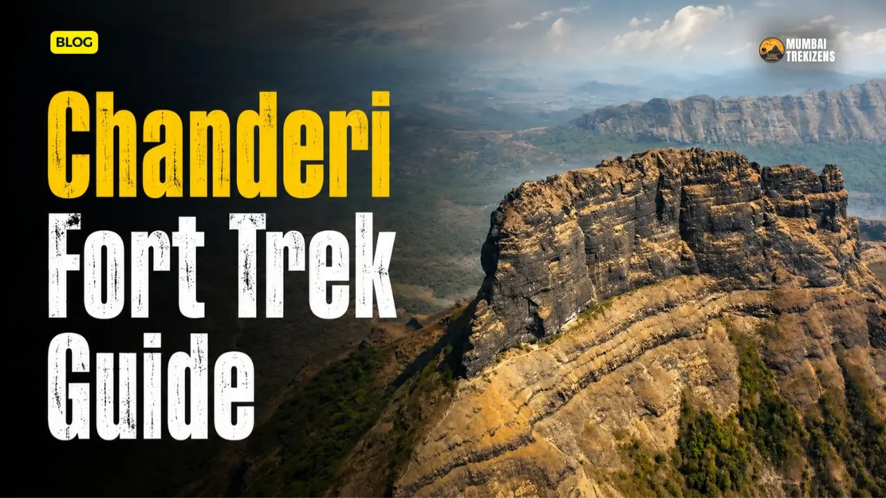
Let me get the important part out of the way first. Most people who trek Chanderi should stop at the cave. Not because the summit is unreachable, but because the section above the cave involves a 30 to 40 ft descent above a gorge, rope work, and exposed rock-cut steps up a pinnacle. Durgbharari grades Chanderi Very Hard. Trekshitiz grades it Hard. Neither of them is being dramatic.
The cave itself is superb. A vast natural chamber in the belly of the pinnacle, big enough for a large group, with a rock-cut cistern outside holding potable water into February. Getting there is a genuinely good three-hour trek through forest, a khind and a ruined gate. That is a full and satisfying day.
Going above it is mountaineering with a fort at the top. Know which trip you are booking.
A Note Before You Search Anything Else
There is a completely different fort called Chanderi in Ashoknagar district, Madhya Pradesh. It has its own long Bundelkhand history, Jain rock sculptures and a Wikipedia page. It has nothing whatsoever to do with the Sahyadri pinnacle described here.
If your search results start talking about Bundelkhand, the Delhi Sultanate or Chanderi sarees, you are on the wrong fort. This guide is about the Chanderi in the Matheran range, between Badlapur and Panvel.
Table of Contents
- Quick Overview
- Where Chanderi Is, and the Height Question
- What Kind of Fort This Is
- How to Reach Chanderi
- The Route From Chinchavli
- The Cave Level: Your Turnaround Point
- Above the Cave: What You Are Actually Signing Up For
- The Summit
- History
- Itinerary
- Water, Food and Shelter
- Budget Breakdown
- Practical Tips
- Safety Tips
- Common Mistakes
- Best Time to Visit
- FAQ
Quick Overview
| Detail | Information |
|---|---|
| Fort range | Matheran |
| District | Thane on the Chinchavli side; Raigad on the Panvel and Tamsai side |
| Base villages | Chinchavli near Badlapur and Vangani; Dundre wadi in Tamsai village near Panvel |
| Height | Reported figures vary widely. See below |
| Grade | Hard (Trekshitiz); Very Hard (Durgbharari); Hard (MTDC) |
| Time to the cave | About 2.5 hours from Chinchavli per Durgbharari; MTDC gives around 1.5 hours from the base |
| Technical gear | Required above the cave. Rope, harnesses, helmets |
| Fortification | Almost none. Only the base of a ruined gate and its bastions survive |
| Water | Potable water in a cistern near the cave into February; four deep cisterns higher up hold water year-round |
| Shelter | The main cave can hold 30 to 40 people outside the monsoon |
| Best season | November to February |
Where Chanderi Is, and the Height Question
Chanderi is a pinnacle in the Matheran range, sitting on the ridge system between Badlapur and Panvel. Trekshitiz lists the region as Thane with Chinchavli as the base village. MTDC lists the district as Thane with the base spelled Chincholi. Durgbharari lists the district as Raigad, which makes sense given they describe the approach from Tamsai village near Panvel.
Both are correct depending on which side you climb from. The mountain straddles the boundary.
On height, our sources disagree badly and we are not going to paper over it:
- MTDC: 1,680 ft above sea level
- Durgbharari header: 2,198 ft
- Trekshitiz: 2,350 ft
- Durgbharari body text: 2,700 ft above sea level
Take the middle of that range, somewhere around 2,200 to 2,400 ft, as the working figure and understand that no authoritative survey number is published on any of the standard fort references. The height is not what makes Chanderi hard anyway. The last 200 vertical feet are.
Around it: Mhaismal hill shares a col with Chanderi, and Nakhind sits in the same cluster. From the top the fort looks out on Matheran, Peb, Prabalgad, Irshalgad, Karnala, Manikgad, Malanggad, Navra Navri and Tavli, with Bhimashankar plateau, Siddhagad, Gorakhgad and Peth further out.
What Kind of Fort This Is
Chanderi is barely a fort. That is not a criticism, it is the point.
There is no fortification to speak of. The gate and its adjoining bastions have been destroyed; only their base survives, and Durgbharari records that as the only remnant of the fort left standing. What you get instead is a series of rock-cut features carved into a natural pinnacle: steps, cisterns, holes cut into the cliff face, caves, and the remains of an outpost at two points on the summit ridge.
Given the cisterns and how little else there is, Durgbharari's reading is that Chanderi predates Shivaji Maharaj's era and was used purely as an observation post. Look at where it sits. Matheran and Peb and Prabalgad to one side, Malanggad the other, Bhimashankar and Siddhagad and Gorakhgad beyond. Chanderi is in the middle of all of them. It was a pair of eyes, not a garrison.
If you want ramparts and gates, this is the wrong trek. Go to Karnala instead.
How to Reach Chanderi
Route 1: Chinchavli, near Badlapur and Vangani (recommended)
This is the route to take on a first visit. Longer than the Tamsai side, but far less steep and much closer to a station.
From Badlapur station on the Central Railway, Chinchavli is about 11 km. From Vangani station, about 8 km. Rickshaws are available from both. MTDC also notes you can walk down to Chincholi from Badlapur station in roughly 45 minutes on the direct approach.
MTDC's alternative walking description: get off at Vangani on the Mumbai–Karjat route, follow the railway track towards Badlapur until Goregaon village, then take the dirt path going left off the main road to Chinchavli at the base of the fort. You can also hire a vehicle from Vangani.
Chinchavli is a small village and Chanderi is not visible from it because of a low hill behind the settlement. That surprises first-timers. Keep walking.
Route 2: Dundre wadi, Tamsai village near Panvel
Durgbharari describes the second approach from Dundre wadi in Tamsai village, on the Panvel side. Both routes converge in the ravine below the fort. The Tamsai path is a steeper climb, and Durgbharari's own recommendation is that Chinchavli is the more convenient way up.
Use Tamsai if you are doing a traverse, or if you are coming from Navi Mumbai and want the harder line. Not for a first visit.
By road
Chinchavli is reachable by car from Mumbai via the Kalyan–Badlapur road, or from Panvel and Navi Mumbai via Karjat road. From Pune, come via the expressway to Khopoli and up towards Karjat and Vangani. Parking is informal, in the village.
Both bases can be reached comfortably in a day from either Mumbai or Pune, which is much of why Chanderi has become popular.
The Route From Chinchavli
Following Durgbharari's description, which is the most detailed available.
Village to plateau. Two paths lead up from Chinchavli to the plateau. Once you are up, Mhaismal hill is on your right and Chanderi is on your left, with a V-shaped notch in the ridge connecting the two. That notch is where you are headed. The path is visible and well-used because the cave below the fort holds a deity that local people visit regularly.
The grassland. About half an hour of grassy plateau walking. Pleasant in November, brutal in April, waist-high and full of ticks in September.
The forest. You enter dense forest at the foothills. The path up through it is the water-flow line in the monsoon. That single fact tells you what it is like in July: a running stream of loose rock. Roughly half an hour, then the path turns right.
To the khind. Another half hour to a small pass connecting Chanderi and Mhaismal. This is the junction that matters. Right goes to Mhaismal hill. Left goes to Chanderi. The path descending in front goes down to Dundre wadi in Tamsai village. Get this wrong and you end up on the Panvel side of the mountain with a long, expensive taxi problem.
The carved section. On the way to the fort from the ravine, you pass holes carved into the rock on the right side of the cliff at one point, and four or five rock-cut steps at two places. These are the first real signs you are on an old route and not just a goat track.
The notch and the gate. About 15 minutes of climbing brings you to a small notch. Villagers have installed an idol of the Goddess in the notch and on the hill facing it. Climb through and you reach the ruined gate of the fort. Base of the gate and bastions only. Through the doorway, rock-cut steps, and the pinnacle standing straight above you.
To the cave. Come under the pinnacle and take the path to the right. On the way you pass two rock-cut cisterns on your left. The first has potable water available until February. The second has silted up with rock and sand. Look up above them and you can see the holes cut in the rock that once carried a roof over the cisterns.
Total to the cave: about two and a half hours from Chinchavli.
The Cave Level: Your Turnaround Point
The main cave is a large natural chamber excavated in places, in the belly of the pinnacle. Durgbharari puts its capacity at 30 to 40 people outside the rainy season. MTDC gives a much more conservative 8 to 10, which likely refers to comfortable overnight sleeping rather than shelter capacity.
Inside there is a Shivling in a marble shrine on a rise in the cave, and a third cistern whose water is not drinkable.
This is where you should plan to stop.
Say it plainly: the cave level is the correct destination for the overwhelming majority of people who trek Chanderi. You have done a real climb, you are inside a striking natural cave with old rock-cut cisterns outside it, you have views across the Matheran range, and you can get back to Chinchavli in daylight without ropes.
MTDC's own note is that because of a landslide, reaching the top of the pinnacle has become extremely difficult, and that the trek beyond the caves is not recommended for casual trekkers.
Do not let group pressure push you higher than this. People die on Sahyadri pinnacles every year, and almost never on the walking sections.
Above the Cave: What You Are Actually Signing Up For
If you are going higher, you need rope, harnesses, helmets and at least one person in the party who genuinely knows how to set an anchor. Not a guy with a rope. Somebody trained.
Here is the terrain, in order:
A small collapsed cave. Beyond the main cave there is another small natural chamber against the cliff, now collapsed and not easily visible.
The 30 to 40 ft descent. You have to go down roughly 30 to 40 feet from here. There is a gorge at the bottom of the slope. Durgbharari is explicit that this section must be crossed carefully with rope and equipment. This is the crux of the whole route and it is a descent, which means you have to reverse it on the way back, tired.
The traverse. Ten minutes of footpath brings you to the second stage of the fort. Partly flat, partly steep.
Four deep cisterns. Below this area are four cisterns cut deep into the rock, holding potable water throughout the year. This is the best water on the mountain, and the fact that somebody cut four deep tanks up here is the strongest evidence that Chanderi was a manned post.
The chimney. From the cistern level, looking up at the pinnacle, you can see small steps carved into the rock. These take you to the upper part. Exposed, narrow, and unforgiving. This is the section that needs a rope belay for anyone who is not a confident climber, and it is why the fort carries a Very Hard grade.
The ravine on the head. The top of the fort is split into two parts by a ravine. This slope has to be climbed carefully. A large square cistern sits on the right of the gorge.
Then some small cliffs, and you are on the summit ridge.
Do not attempt any of this in the monsoon. Multiple sources are consistent that the final climb is hazardous in the rain and should not be tried at all. Wet basalt above a gorge is a straightforward way to end a life.
The Summit
The head of the fort is a long ridge path with the remains of an outpost at two places along it. Space for about 20 people at the top. There is an idol of Shivaji Maharaj seated on his throne, with a saffron flag beside it.
The view is why people take the risk. South towards Matheran, Peb and Prabalgad. North to Malanggad. Beyond that, the Bhimashankar plateau, Siddhagad, Gorakhgad and Peth. Trekshitiz adds Kalavantin Durg, Irshalgad, Karnala, Nakhind, Vikatgad, Mhaismal, Tavli and Navra Navri to the list.
Chanderi sits in the geometric centre of all of it. On a clear December morning you can see most of the northern Konkan fort network from a single standing position, which is exactly what it was built for.
If you like this kind of exposed pinnacle terrain and want more of it, Kalavantin Durg and Prabalgad are in the same visual field and a good deal more forgiving.
History
Chanderi's recorded history is thin, which fits an outpost.
The cisterns cut into the rock at the upper level suggest use before Shivaji Maharaj's era.
In 1656, Shivaji Maharaj captured Kalyan, Bhiwandi and the Rairi province, which brought this belt into Maratha hands.
After the death of Sambhaji Maharaj, in 1689, the Mughal chief Matabbar Khan captured Chanderi fort along with Kalyan and Malanggad.
That is what the sources support. Anything more elaborate you read about Chanderi's history online is almost certainly borrowed from the unrelated Chanderi in Madhya Pradesh.
Itinerary
Cave-level day trip from Mumbai:
5:30 am Board a Karjat-bound local. Get down at Badlapur or Vangani.
7:15 am Rickshaw to Chinchavli.
7:45 am Start walking.
8:15 am On the plateau. Mhaismal right, Chanderi left.
9:15 am Into the forest section.
10:00 am The khind. Take the left branch.
10:20 am Rock-cut steps and holes in the cliff.
10:45 am Notch with the Goddess idol, then the ruined gate.
11:00 am Cisterns, then the cave. Rest, eat, look around.
12:30 pm Start down. Same route.
3:00 pm Chinchavli.
4:00 pm Train from Badlapur.
If you are summiting: add three to four hours minimum and start at first light. Fix a hard turnaround time at the cave on the way back down, and honour it.
Water, Food and Shelter
Water. The first cistern below the cave has potable water until around February. Four deep cisterns at the second stage of the fort hold potable water all year, but those are above the rope section. MTDC notes water is generally available in the reservoir until the end of October depending on the monsoon. The cistern inside the cave is not drinkable.
Carry three litres per person anyway. Treat cistern water as a bonus, not a plan.
Food. Nothing on the mountain. Nothing reliable at Chinchavli. Buy at Badlapur or Vangani and carry it. Carry the wrappers back out.
Shelter. The main cave is the shelter. It works outside the monsoon. It is also a place of worship for local people, so behave accordingly: no alcohol, no shoes on the shrine platform, no litter.
Budget Breakdown
Per person, cave-level day trip by train from Mumbai.
| Item | Cost |
|---|---|
| Local train return to Badlapur or Vangani | Rs 40–80 |
| Rickshaw both ways to Chinchavli | Rs 150–300 |
| Breakfast | Rs 60–100 |
| Packed lunch, snacks, water | Rs 200 |
| Buffer | Rs 100 |
| Total | Rs 550–780 |
There is no entry fee at Chanderi.
If you are summiting with a technical group, expect Rs 1,500–3,000 per person for an organised climb with fixed ropes and equipment. Pay it. This is not the trek to save money on gear.
Practical Tips
Start early. Non-negotiable. The forest section eats time and the descent takes longer than you think.
Offline maps, downloaded before you leave. Network is unreliable through the forest and on the plateau.
The khind junction is the one navigation decision that matters. Left for Chanderi. Photograph the junction so you recognise it on the way back.
Full trousers and closed shoes with real grip. The rock-cut steps are polished smooth in places.
Helmets, if you are going above the cave. Rockfall in a chimney is not theoretical.
Carry a headlamp per person even for a cave-level day trip.
Do not go alone. Every source that discusses Chanderi says this, and it is one of the few pieces of trek advice that is genuinely non-negotiable here.
A basic trauma kit is more relevant on this trek than on most. Our first aid kit list for Sahyadri treks covers what to actually pack.
Safety Tips
Know your turnaround. Decide at the base whether you are a cave party or a summit party. Changing your mind at the cave because the group is enthusiastic is how accidents happen.
The 30 to 40 ft descent above the gorge is the crux. Rope it. Both directions.
The final chimney is exposed rock-cut steps on a pinnacle. Belay anyone who is not clearly comfortable.
No monsoon summit attempts. None. The final climb is documented as hazardous in the rain and should not be attempted. The cave-level trek in the monsoon is doable with care, but the forest path is a watercourse and the descent is slick.
Rockfall. Do not stack your group vertically in the chimney. Wait, then move.
Bees. Sahyadri cliff overhangs carry rock bee colonies. Keep noise down near cliff faces.
Descent timing. Be off the rock and back on the forest path by 3 pm at the latest in winter.
Emergency: dial 112. Nearest hospitals are at Badlapur and Ambernath, with Kalyan for anything major. A rescue from above the cave would be slow and technical, which is another argument for stopping at the cave.
Before any monsoon visit here, read our monsoon trekking safety guide for the Sahyadri.
Common Mistakes
Researching the wrong Chanderi. The Madhya Pradesh fort dominates search results. Check that whatever you are reading mentions Matheran, Chinchavli or Panvel.
Taking the wrong branch at the khind. Right goes to Mhaismal, straight down goes to Tamsai, left goes to Chanderi.
Assuming the summit is a normal trek finish. It is a technical climb above a gorge. Grades of Hard and Very Hard from the two standard fort references are not marketing.
Bringing a rope but no one who can use it. Worse than bringing nothing, because it creates false confidence.
Attempting the summit in the monsoon. Simply do not.
Counting on cistern water in April. The first cistern holds until around February. After that, carry everything.
Descending after dark. The forest section is a watercourse full of loose rock and it is genuinely bad in the dark.
Best Time to Visit
November to February. The only sensible window for a summit attempt, and the best window for the cave trek too. Dry rock, cool forest, clean long-range visibility over the Matheran range, and the first cistern still holding water.
October. Good. Green, drying out, waterfalls still running at the foothills. The rock above the cave may still be greasy, so keep it to a cave-level trip.
March to May. Do the cave and go home early. The grassland stretch is unshaded and the heat is real. Water sources below the cave will be gone.
June to September. The area around the foothills is beautiful and draws people for the waterfalls. Fine for a monsoon walk to the cave with a group who accept slippery rock. Absolutely not for the summit.
Weekdays over weekends if you can manage it. The cave gets busy on Sundays because it is also a local shrine, and the sections above it are no place for a queue.
FAQ
Where is Chanderi Fort located? In the Matheran range of the Sahyadris, between Badlapur and Panvel. Trekshitiz and MTDC list the region as Thane district with Chinchavli as the base village; Durgbharari lists it as Raigad, reflecting the approach from Tamsai near Panvel. It is not the Chanderi in Ashoknagar district, Madhya Pradesh.
How difficult is the Chanderi Fort trek? Trekshitiz and MTDC grade it Hard. Durgbharari grades it Very Hard. The walk to the cave is moderate to hard. Everything above the cave is technical and requires rope.
Can beginners do the Chanderi Fort trek? A fit beginner can reach the cave with an experienced group. The summit pinnacle is not for beginners under any circumstances.
How long is the trek to Chanderi Fort? Durgbharari gives about two and a half hours from Chinchavli to the cave. MTDC gives roughly an hour and a half from the base village. Add three to four hours if you are going to the summit.
Do I need equipment for Chanderi Fort? Not to reach the cave. Above the cave, yes. Rope, harness and helmet, plus someone who knows how to rig an anchor. Durgbharari states explicitly that rope and other equipment are necessary for the section above the cave.
Is there water on Chanderi Fort? Yes. A rock-cut cistern below the cave holds potable water until around February. Four deep cisterns at the second stage of the fort hold potable water year-round, but they are above the rope section. The cistern inside the cave is not drinkable.
Can you stay overnight on Chanderi? The main cave can shelter a large group outside the monsoon, with Durgbharari putting the figure at 30 to 40 people. It is also a local place of worship, so treat it with respect.
How do I reach Chanderi from Badlapur station? Chinchavli is about 11 km from Badlapur station and about 8 km from Vangani station, with rickshaws available from both.
What can you see from the top of Chanderi? Matheran, Peb and Prabalgad to the south, Malanggad to the north, and Bhimashankar plateau, Siddhagad, Gorakhgad and Peth beyond, along with Karnala, Irshalgad, Manikgad, Kalavantin Durg, Nakhind, Tavli and Navra Navri.
Is there an entry fee at Chanderi Fort? No entry fee is documented at Chanderi.
Chanderi is two treks wearing one name. One is a fine, hard, three-hour walk through forest and a khind to a large cave with old cisterns and a Shivling, with views across the whole Matheran range. The other is a technical pinnacle climb over a gorge that has claimed the confidence of a lot of people who thought a trek grade was a suggestion.
Pick the first one. Do it properly, in December, with an early start and a group. Sit in the cave, drink water from a cistern somebody cut into rock centuries ago, and look at Prabalgad across the valley.
Then, if you still want the summit, come back with equipment and someone qualified. Not the same day. Not on a whim.
Ready for Your Next Adventure?
Don't just read about it — come experience it. Explore our upcoming treks, camps and tours, all run with certified leaders and small groups.
🏷 Chanderi Fort Matheran range, Chanderi trek Chinchavli, Chanderi Fort caves, Chanderi pinnacle climb, Chanderi Fort Badlapur, how to reach Chanderi Fort from Badlapur station, Chanderi Fort trek difficulty level, is Chanderi Fort trek safe for beginners, Chanderi Fort cave water availability, Chanderi trek from Tamsai Panvel route
Be the first to comment on this post.