Introduction
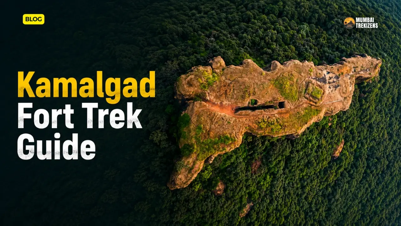
Most people driving through Wai never look north. They are heading to Panchgani or Mahabaleshwar, and the ridge above the Dhom backwaters is just scenery. That ridge holds the Kamalgad fort trek — a quiet, forested climb to what the Satara District Gazetteer records as a summit 4,511 feet above sea level, making it the highest fort in Satara district.
Kamalgad is odd. There is no grand gateway. No barracks, no temple on top, no crowd of Sunday selfie takers. What it has instead is a flat, scrubby plateau of three or four acres and one deep rock-cut pit that trekkers descend on slippery steps, into red earth and cold air. The Gazetteer, written in the colonial period, records a grim story about that pit. Whether you believe the story or not, standing at the bottom of it is a genuinely strange experience.
This guide covers the approach from Tupewadi and Vasole, the actual walking time, what is and is not verified about the fort, and how to fit Kamalgad into a Satara or Wai weekend.
Table of Contents
- Quick Overview
- Where Kamalgad Is, and What It Is Called
- The Fort's History — What Is Documented
- The Well: Kave Vihir, Geru, and the Gazetteer's Story
- What You Actually See on Top
- Trek Route from Tupewadi
- Difficulty: An Honest Read
- How to Reach Kamalgad
- Suggested Itinerary
- Accommodation
- Food and Water
- Nearby Attractions
- Budget Breakdown
- Practical Tips
- Safety Tips
- Common Mistakes
- Best Time to Visit
- FAQ
Quick Overview
| Detail | Information |
|---|---|
| Location | Wai taluka, Satara district, Maharashtra |
| Other names | Bhelanja, Kattalgad ("death fort") |
| Height | 4,511 ft / 1,375 m per the Satara District Gazetteer and Wikipedia; Durgbharari lists 4,430 ft |
| Base village | Tupewadi, near Vasole |
| Trek distance | Approximately 5–6 km one way from the road-head |
| Trek duration | About 2 hours up to the machi, roughly 15–20 minutes more to the top |
| Difficulty | Easy to moderate. Durgbharari grades it "medium" |
| Best season | Late June to early February |
| Entry fee | None reported |
| Permit | Not required |
| Water on route | One spring-fed tank near the Gorakshanath temple |
Note the height disagreement. The Satara District Gazetteer and Wikipedia both give 4,511 feet. Durgbharari's page header says 4,430 feet, and confusingly its body text mentions 3,000 feet for the upper citadel, which does not square with either. Use 4,511 ft as your working figure, since that is the government gazetteer number, and treat the rest as noise.
Where Kamalgad Is, and What It Is Called
Kamalgad sits in Wai taluka of Satara district, at coordinates roughly 18°05′N, 74°00′E. The Gazetteer places it "about ten miles due west of Wai" — sixteen kilometres. Wikipedia adds that it is 32 km from Satara city.
You will see Kamalgad wrongly listed under Pune district on several travel sites. It is not. Wai is Satara. The old railway reference in the Gazetteer is Wathar station, about 35 miles east.
The hill divides the head of the Krishna valley. The Valki river flows to its north, the Krishna proper to its south, and the two streams meet at the fort's eastern base. That geography is the whole reason the hill was worth watching from.
Three names attach to the fort. Kamalgad means lotus fort. Bhelanja appears in Harish Kapadia's Trek the Sahyadris. Kattalgad, meaning death fort, is the name that appears in early Marathi documents written in the now-defunct Modi script. Some trekking write-ups also use "Kalkot" or "Chor Kholi" for the pit on top. Neither of those names appears in the Satara District Gazetteer or on Durgbharari, so treat them as informal usage rather than a documented historical name.
The Fort's History — What Is Documented
Honest answer: not much is documented, and anyone who tells you a confident founding date is guessing.
The Gazetteer states plainly that the builder is unknown, and that the fort is "probably very old". Durgbharari records a belief that Kamalgad was among the forts raised by Bhoj of the Shilahara line at Panhala, but frames it as belief, not record.
What is on firmer ground:
- During Maratha times, Kamalgad, Pandavgad and other forts in this pocket were administered by a mokasaddar, a manager appointed from Bijapur.
- Chhatrapati Shivaji Maharaj's forces took nearby Kenjalgad between 1670 and April 1674, and Kamalgad is thought to have changed hands in the same window.
- In April 1818, Kamalgad surrendered to a British detachment under Major Thatcher, after resistance. That date is in the Gazetteer.
Wikipedia also notes a claim that the British used the fort to execute prisoners of war. That claim traces back to a personal blog rather than an official record, so it stays in the "reported, not established" column.
The Well: Kave Vihir, Geru, and the Gazetteer's Story
This is why you climb Kamalgad.
On the flat top there is a rectangular shaft cut straight down through the rock. The Gazetteer describes it as the remains of a deep well "sunk right through the rocky layer constituting the scarp and penetrating to the soil below which seems still to be full of water". It then records that the sides of the well were said to contain recesses in which criminals were placed, "to choose between starvation and throwing themselves down into the water". The same passage notes that no traces of those recesses remained even when the Gazetteer was compiled.
That is where the name Kattalgad — death fort — most likely comes from.
There is a competing and much less dramatic explanation. Kapadia's account, cited on Wikipedia, suggests the shaft may simply have been a quarry for red ochre, or geru, which is plentiful in this region. Durgbharari calls the shaft the "Geru / Kave" well and describes it exactly the way you will find it: red, damp, cold, and slippery from the ochre soil.
The depth figures do not agree either. The Gazetteer, writing in the nineteenth century, says the surviving hole was only eighteen to twenty feet deep although the original well was thirty or forty. Durgbharari, describing a 2020 visit, calls it 80–90 feet deep with sixty to seventy cut steps descending to the bottom, cave-like chambers at the base, and light openings in the ceiling. A new iron rope handrail has been fixed beside the steps.
Both accounts can be true if debris was cleared at some point. Just do not repeat a single confident number.
Go down slowly. The steps are worn, wet almost year-round, and coated in fine red silt that behaves like grease. Use the rope. Do not descend in flip-flops, and do not descend alone.
What You Actually See on Top
Very little, and that is the point.
There is no gateway. The Gazetteer is emphatic about this: no buildings, no walls, no gate of any kind, which is genuinely unusual for a Sahyadri fort. Height and a continuous scarp were the defence.
The old approach was through an artificial tunnel or funnel cut upward from the base of the scarp, emerging on the summit. It is blocked. A large boulder fell into it and was never removed, so you will not be walking through it. Today the way up the last scarp is a fixed iron ladder installed where the old cut steps collapsed, followed by seven or eight steps into the fort.
On top you will find a square foundation with a flagpole and saffron flag, remains of a bastion on the eastern side, patches of rampart, and the well. Ten minutes covers the whole circuit.
The views are the payoff. Kenjalgad, the Raireshwar plateau, the Koleshwar plateau and Panchgani on one side. Dhom Dam to the east. Chandan-Vandan, Pandavgad and Vairatgad in the distance. On a clear post-monsoon morning the Krishna valley opens out below you in layers.
Trek Route from Tupewadi
Drive to Vasole, then continue to Tupewadi. From Tupewadi an unpaved road runs past the village school for about half a kilometre to a house at the foot of the hill. A private vehicle can reach this point. There is an information board here.
From the base:
- Base to the shoulder of the hill — about 1 hour. The path is well used, because villagers walk it to the Dhangarwada and the Gorakshanath temple. Arrows are painted at intervals. Cattle trails branch off, which is where people go wrong. The reliable trick, noted by Durgbharari, is to follow the line of electricity poles; they run halfway up the hill and there is only one prominent path continuing above them.
- Turn left along the ridge. There is a bench-cum-signboard at this junction.
- Fifteen minutes to the Gorakshanath temple, under heavy tree cover. Three Nath idols and one wooden idol inside, with a paved courtyard and a sheet roof. Ten to twelve people can sleep here.
- Five to ten minutes beyond the temple, a water tank sits on the left of the path. It is fed by a perennial spring and it is the only water on the whole route. Fill up here in both directions.
- Fifteen to twenty minutes of thick forest brings you to the machi, a cleared plateau with two houses and cultivated ground. The summit and its flag appear for the first time from here.
- The final scarp. Past a rubble rampart and a corner bastion, then the iron ladder, then a handful of steps into the fort.
Wikipedia's summary times the base-to-machi walk at about two hours and gives twenty minutes from the machi to the balekilla, describing the citadel as a scarp rising 30–40 feet above the forested plateau. Durgbharari's stage timings add up to something similar. Budget three to three and a half hours up if you stop to look at things.
The Gazetteer records three historical approaches: from Asgaon to the east, Vasole to the north, and Partavdi to the south. The Vasole–Tupewadi line is the one in current use. A trail from Vasole also merges with the trail from Nandgane.
Difficulty: An Honest Read
Kamalgad is not a hard trek. It is a long forested walk with a short awkward finish.
The gradient is steady and shaded. Wikipedia calls the route "very safe". Durgbharari grades it medium, which is fair once you factor in the last scarp and the well.
Two things make it more than a stroll:
- The iron ladder on the final scarp. It is short, but it is a ladder on exposed rock, and it will feel unpleasant to anyone with a fear of heights.
- The well descent, which is the single most slip-prone place on the entire trek.
Children over about ten who walk regularly will manage the trail. Whether you take them into the well is your call, and I would not.
If you want a comparison from within the district, this is easier and shorter than Vasota fort and far less technical than something like Harihar fort.
How to Reach Kamalgad
From Pune
Two roads, and the choice matters a lot.
Route A — Pune to Wai to Vasole. Roughly 120 km total per Durgbharari. The last 30 km stretch from Wai to Vasole is in poor condition.
Route B — Pune to Bhor to Korle to Raireshwar to Vasole. Roughly 100 km, and Durgbharari describes the road as good.
Take Route B. It is shorter and the surface is better. Route A only makes sense if you are already stopping in Wai.
Wikipedia notes Tupewadi as 30 km from Wai and 46 km from Bhor.
From Mumbai
There is no clean public-transport line to Tupewadi. Drive down the Mumbai–Pune Expressway, join NH48 towards Satara, exit for Wai, and follow the Wai–Vasole road. Expect roughly five to six hours door to door on a good day, more in monsoon. If you would rather not do that in one morning, sleep at Wai or Panchgani the previous night.
By train
The nearest useful railheads are Satara and Wathar on the Pune–Miraj line. The Gazetteer lists Wathar as the fort's reference station. From either you will need a taxi; there is no direct bus to Tupewadi.
By ST bus
MSRTC buses run frequently to Wai from Pune's Swargate stand and from Satara. Onward connections to Vasole are infrequent village services. Confirm the return timing at Wai stand before you commit, or you will be hitching back after dark.
Suggested Itinerary
Single day from Pune
| Time | Plan |
|---|---|
| 4:30 AM | Leave Pune via Bhor and Raireshwar |
| 7:30 AM | Reach Tupewadi, park at the hill-base house, start walking |
| 9:00 AM | Gorakshanath temple, fill water |
| 9:45 AM | Machi |
| 10:15 AM | Summit and the Kave well |
| 11:30 AM | Begin descent |
| 1:00 PM | Back at the base, lunch in Vasole or Wai |
| 5:30 PM | Pune |
Overnight version. Sleep in the Gorakshanath temple courtyard, be on the summit for sunrise, descend by mid-morning, and add Kenjalgad or the Raireshwar plateau on the way back. This is the better trip if you can spare the night.
Accommodation
There is nothing commercial at the base. Your options:
- Gorakshanath temple on the fort route — space for around ten to twelve people, mats and sleeping bags of your own.
- The machi, where a small number of families live and cultivate the clearing. Wikipedia notes that the resident household can arrange a night halt and food at modest cost. Ask politely, agree the amount in advance, and pay properly.
- Wai — the practical base, with a range of hotels and lodges.
- Bhor — an alternative if you are approaching from that side.
- Panchgani and Mahabaleshwar — plenty of rooms, higher prices, about an hour and a half away.
Food and Water
Carry everything. There is no shop, no stall and no tea point on the trail.
The one water source is the spring-fed tank near the Gorakshanath temple, which Durgbharari describes as perennial. Filter or purify it anyway. In February and March, when everything else in this belt has dried out, that tank is what you are relying on, so top up both going up and coming down.
Two litres per person in winter. Three in October and March. Add electrolytes.
Eat properly in Wai before or after. Wai has decent Maharashtrian thali places and the town itself, strung along the Krishna ghats, is worth an hour.
Nearby Attractions
- Kenjalgad, the natural twin outing to Kamalgad, known for its rock-cut steps. Visible from Kamalgad's summit.
- Raireshwar plateau, associated with the oath Shivaji Maharaj is traditionally said to have taken, and spectacular in the flowering season.
- Dhom Dam, on the Krishna just outside Wai, and the reservoir view you get from the fort.
- Pandavgad and Vairatgad, both short Wai-area forts, both visible from Kamalgad.
- Wai's riverfront ghats and the Dholya Ganpati temple.
- Panchgani and Mahabaleshwar, if you want to turn this into a two-day loop.
- Kaas Plateau in the flowering weeks of late August and September, about two hours south.
Budget Breakdown
Per person, group of four sharing a car, one day from Pune.
| Item | Cost (₹) |
|---|---|
| Fuel and tolls, split four ways | 500–700 |
| Breakfast on the road | 80–150 |
| Packed lunch and snacks | 150–250 |
| Lunch or tea at Wai on the way back | 150–250 |
| Entry fee | 0 |
| Parking at base | 0–50 |
| Miscellaneous | 100 |
| Total | ₹980–1,500 |
By bus and shared vehicle, the same day costs roughly ₹600–900 but eats several extra hours. If you halt overnight at the temple or on the machi, add ₹200–400 for food arranged locally.
Practical Tips
Load the offline map before you leave the highway. Mobile signal in the Vasole–Tupewadi pocket is patchy and disappears entirely once you are in the forest.
Trekking shoes with real lugs. The ochre in and around the well makes an absolute mess of smooth soles — read our footwear guide for Sahyadri terrain if you are still trekking in running shoes.
Carry a headtorch even for a day trip. The well is dark at the bottom, and the light shafts in the ceiling are not enough to see the steps clearly.
Follow the electricity poles on the lower half. It is the single most useful navigation cue on this route.
Leave the base by 8 AM at the latest. The forest is pleasant, but the descent is faster and safer in daylight, and village transport dries up by evening.
Take your litter home. There is no waste system at Tupewadi and no staff on the fort.
Safety Tips
The well is the hazard. Wet cut steps, red silt, no railing except the fixed rope. Descend facing in, one at a time, using the rope with both hands where you can. If the steps look glazed, skip it. The fort is still worth the walk.
The iron ladder. Check the fixings before you weight it. One person on the ladder at a time.
Monsoon. The trail is walkable in the rains and the forest is beautiful, but the ladder and the well become genuinely risky. Read our monsoon trekking safety notes before you go in July or August.
No rescue nearby. This is a thinly visited fort with no staff, no signal on the upper section and no road access past Tupewadi. Carry a proper first aid kit and tell someone your plan.
Wildlife. Thick forest, cattle trails, and cover on both sides. Snakes are active in the monsoon and immediately after. Walk with a stick, do not put hands into rock crevices, and see our wildlife safety guide.
Sun. The machi and the summit are open and exposed. Between March and May, the top is punishing by eleven.
Common Mistakes
Trusting the Wai–Vasole road. It is 30 km of bad surface. The Bhor–Raireshwar road is longer on the map and faster in reality.
Not filling water at the temple tank. There is nothing after it, and nothing on top.
Going down the well in the wrong shoes, or going down alone.
Arriving in mid-April expecting green. The forest cover is good but the region is scorched by then, and the tank is at its lowest.
Confusing Kamalgad with Kenjalgad. They are neighbours with similar profiles and different climbs. Kenjalgad has the famous rock-cut staircase; Kamalgad has the well.
Assuming there is a village shop. There is not.
Best Time to Visit
October to February — best. Clear air, comfortable temperatures, the Krishna valley in view, and the well steps a little less lethal than in the rains. Late November and December are the sweet spot.
Late June to September — good with caveats. The forest is at its best and the whole ridge is green. The ladder and the well become slippery. Visibility can be zero for hours. Go only if you are comfortable in monsoon conditions.
March to mid-May — skip it. Hot, hazy, dry, and the exposed machi and summit are unpleasant after 10 AM.
Time of day: start at first light. The best views from the summit are between 7 and 10 AM.
Frequently Asked Questions
How high is Kamalgad fort? The Satara District Gazetteer and Wikipedia both record 4,511 feet (1,375 m) above sea level, which makes it the highest fort in Satara district. Durgbharari lists 4,430 feet. The gazetteer figure is the one to quote.
What is the base village for the Kamalgad trek? Tupewadi, reached via Vasole. A rough track runs from Tupewadi past the school to the hill base, and private vehicles can usually drive to that point.
How long does the Kamalgad trek take? About two hours from the base to the machi, and roughly fifteen to twenty more to the fort top. Allow five to six hours for the round trip with time on the summit.
Is there an entry fee or permit for Kamalgad? No entry fee or permit has been reported for Kamalgad. It is an unmanned fort with no ticket counter and no gate staff.
Why is Kamalgad called Kattalgad? Kattalgad means death fort. Early documents in the Modi script use this name. The Satara District Gazetteer records a tradition that criminals were placed in recesses in the walls of the fort's deep well and left to choose between starvation and drowning.
Is the well safe to climb into? It has cut steps and a fixed iron rope, and trekkers do descend it. It is also permanently damp, coated in red ochre silt, and slippery. Descend one at a time, use the rope, carry a torch, and skip it entirely if conditions look bad.
Can beginners do the Kamalgad trek? Yes, for the walk itself — it is a shaded, steady climb on a well-used path. The iron ladder near the top and the well descent are the parts that beginners should approach carefully.
Is water available on the Kamalgad trek? One spring-fed tank near the Gorakshanath temple, about five to ten minutes beyond the temple on the fort path. It is described as perennial. Purify before drinking, and fill up in both directions.
Kamalgad rewards a certain kind of trekker. If you want gateways, ramparts and a photogenic Maratha silhouette, go to Rajgad. If you want a shaded forest walk to an empty plateau with one very strange hole in it, and a valley view that almost nobody in your feed has posted, this is your fort.
It is the highest fort in Satara district and one of the least visited. That combination does not last forever. Go in December, go early, and go down the well carefully.
Ready for Your Next Adventure?
Don't just read about it — come experience it. Explore our upcoming treks, camps and tours, all run with certified leaders and small groups.
🏷 - Kamalgad fort height, - Kamalgad Tupewadi base village, - highest fort in Satara district, - Kamalgad Kattalgad Bhelanja, - Kamalgad well trek, - Kamalgad fort trek route from Tupewadi village, - how to reach Kamalgad fort from Pune, - Kamalgad fort trek difficulty and duration, - Kamalgad fort Kave vihir red ochre well, - Kamalgad fort trek best season Wai Satara
Be the first to comment on this post.