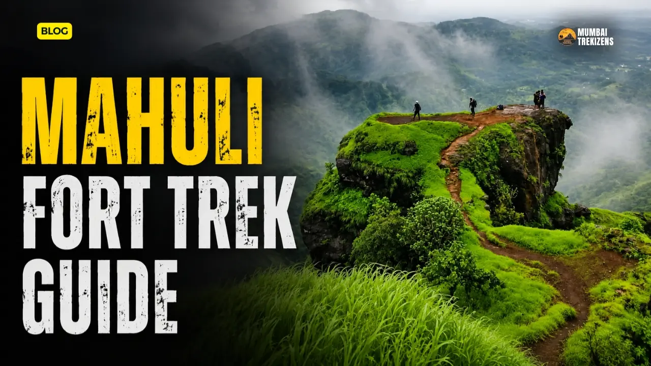
The Mahuli Fort trek gets you to 2,815 ft, the highest point in Thane district, on a route you can start from a Central Railway platform. That combination is why it is one of the busiest weekend treks near Mumbai and also why it is one of the most consistently underestimated.
It is not a hard trek. It is a long, hot, badly-signposted one with a genuine ladder near the top and a plateau that swallows people. Every monsoon, groups reach the top with two hours of daylight left and no idea which of four paths they came up.
Here is the version that actually gets you up and down.
Table of Contents
- Quick Overview
- Where Mahuli Actually Is
- The History
- How to Reach Mahuli
- Forest Department Entry and Sanctuary Rules
- The Route, Step by Step
- The Iron Ladder Section
- Where People Get Lost
- On the Plateau
- The Three-Fort Circuit
- Itinerary
- Accommodation and Food
- Budget Breakdown
- Practical Tips
- Safety Tips
- Common Mistakes
- Best Time to Visit
- FAQ
Quick Overview
| Detail | Information |
|---|---|
| Location | Shahapur taluka, Thane district, Maharashtra |
| Height | 2,815 ft (858 m) above sea level, the highest point in Thane district |
| Base village | Mahuli, approximately 5 km from Asangaon railway station |
| Distance from Mumbai | Approximately 77 km |
| Distance from Thane | Approximately 55 km |
| Nearest railway station | Asangaon, Central Railway |
| Ascent time | Around 2 hours from Asangaon per MTDC; around 3 hours from base per Durgbharari |
| Time to explore the plateau | About 2 hours |
| Difficulty | Rated Easy by MTDC, Medium by Durgbharari. In practice, moderate |
| Protected status | Declared a protected monument; falls under Tansa Wildlife Sanctuary jurisdiction |
| Best season | November to February |
The two most-cited sources give different difficulty grades. Trust the middle. It is a moderate day out for a fit walker and a hard one for a first-timer.
Where Mahuli Actually Is
Shahapur taluka, Thane district. Not Raigad. You will find old trek listings that put Mahuli in Raigad and they are simply wrong.
The base village is Mahuli, about 5 km from Asangaon station on the Mumbai–Nashik line. Durgbharari puts the distance at 77 km from Mumbai and 55 km from Thane. The Thane–Nashik highway runs past Asangaon, which is what makes this trek so accessible.
Mahuli is not a single hill. It is a group of three forts separated by ravines, with Palasgad to the north, Mahuli in the centre and Bhandargad to the south. The middle one, Mahuli, is the largest and gives access to the other two. Around and between them stand the pinnacles that made Mahuli a rock-climbing destination: Vazir, Vishnu, Bhatoba, Navra, Navri and Karavli.
The forest surrounding Mahuli has been declared a sanctuary, and the fort comes under the jurisdiction of the Tansa Wildlife Sanctuary, administered by the Maharashtra Forest Department. A Mahuli Gad Eco Development Committee was formed under joint forest management to run ecotourism at the base.
The History
Nobody knows who built Mahuli. What is documented is that it came under Malik Ahmad, founder of the Nizamshahi, around 1485, after the fall of the Bahmani kingdom. Its position mattered: near Kalyan county, connected to Nashik, Surat, Junnar and Ahmednagar.
Around 1635-36, when the combined Mughal and Adilshahi forces moved to finish off the Nizamshahi, Shahaji Raje took refuge at Mahuli with Jijabai and the young Shivaji. Khan Jaman besieged the fort. Shahaji asked the Portuguese for help. They refused. He surrendered.
Shivaji Maharaj captured Mahuli from the Mughals on 8 January 1658. He lost it in 1661, regained it, then handed it back under the Treaty of Purandar in 1665, cleverly counting the connected hills as three separate forts against his quota.
In February 1670 he attacked Mahuli directly and failed. Manohardas Gaud, the Mughal commander, was ready for it. Around a thousand Mavalas were killed, most of them from villages nearby. Gaud later abandoned the fort anyway and was replaced by Alavardi Beg. On 16 June 1670, after a two-month siege, Moropant Trimbak Pingle took Mahuli, Bhandargad and Palasgad for the Swarajya.
After Sambhaji Maharaj's death the fort keeper handed it to the Mughals. The Marathas got it back in 1735 through bribery and internal division rather than assault, which tells you something about how hard the place was to storm. Bajirao II handed it to the British in 1817.
Shivdurg Pratishthan has been carrying out conservation work on the fort, clearing bush around the Mahuleshwar temple and the Hanuman Darwaza.
How to Reach Mahuli
By train from Mumbai
This is the correct way to do Mahuli.
Take a Central Railway slow or fast local towards Kasara and get off at Asangaon. From CSMT it is roughly two hours; from Thane, around an hour. Trains towards Kasara start early, which matters, because the whole trek hinges on being at the base by 7 am.
From Asangaon station, share autos run to Mahuli village, roughly 5 km. They fill up quickly on weekend mornings. You can also walk it if the autos have dried up, but that is an hour you did not budget for.
By road
From Mumbai or Thane, take the Nashik highway to Asangaon and turn off to Mahuli village. Parking is available near the temples at the base. Roughly 77 km from Mumbai, 55 km from Thane.
From Pune
Long and awkward. Pune to Kalyan and then out on the Nashik road, or via the expressway and Thane. Around four to five hours. If you are in Pune, there are better forts closer to you.
The alternative Vasind approach
MTDC documents a second route from Vasind station, going north to Duhagaon and then Charyacha Pada, ascending the western trunk of Mahuli to reach the Kalyan Darwaja and Bhandargad. It is described as quite difficult. It is not the route for a first visit and you should not attempt it without someone who has done it.
Forest Department Entry and Sanctuary Rules
There is a forest department tourist centre at the base, past the newly constructed arch on the path behind the Shiv temple. Durgbharari records an entrance fee of Rs 20 per person.
Treat that as the documented figure rather than a guarantee. The forest department revises rates, and there is no official published tariff page for Mahuli that we could verify. Carry small cash. No counter here is going to accept UPI reliably given the network.
The area falls under Tansa Wildlife Sanctuary. What that means in practice:
- No plastic left behind. This is enforced more seriously than it used to be.
- No alcohol.
- No loudspeakers or portable speakers.
- No fires.
- Overnight camping is restricted. Do not assume you can pitch a tent because a blog from 2016 said so.
The forest gate has closing hours. If you arrive at the base at 11 am you may be turned back, and you would deserve it.
The Route, Step by Step
Start at the cluster of temples in Mahuli village. There are three old temples here, one to Ganesha, one to Shiva and one to the village deity, along with scattered sculpture and a medieval lake.
Behind the Shiv temple, a road goes right. A few minutes along it is the Ganesha temple, with a hand pump in front of it. That hand pump is your last certain water. Fill everything.
Past the newly built arch, you reach the forest department tourist centre. Pay, and start climbing.
The path is clear because it is heavily used, running through sparse forest. It is steep almost immediately. You cross a hill and a stream and come to a flat stretch where remains of structures are visible. During the Peshwa period there were officials' quarters and mansions at the foot of Mahuli.
From here the trail steepens into jungle. There are two or three short rock sections where you will use your hands. None of them are technical. All of them are slippery in the monsoon.
In about two hours you reach the base of the fort's ramparts.
The Iron Ladder Section
The ramparts in this part still stand, and an iron ladder roughly 15 to 20 ft high has been installed to get you over them onto the ridge.
Understand what this ladder is. It is not the original way onto the fort. Mahuli's real gates are the Mahadarwaja, the Hanuman Darwaza, the Kalyan Darwaza, and the passes at Vandre, Palasgad and Mahuli. The ladder is a modern shortcut, and it is now the shortest and easiest way up.
Current condition: the ladder is in place and in regular use. Trekker reports over recent seasons describe the base as not fully steady, held by a chain bolted to the old wall, with rungs sitting at a slight backward slant so you lean out as you climb. We could not verify the ladder's condition against any forest department or ASI inspection record, so treat this as reported rather than official.
How to climb it sensibly:
- One person at a time. Not two, not three. Weight on that ladder is the whole question.
- Three points of contact. Always.
- Nothing in your hands. Bag on your back, phone in your pocket.
- Do not photograph anyone from directly below the ladder.
- In the monsoon the rungs are wet metal and your soles will be caked in red mud. Wipe them on a rock first.
If someone in your group is genuinely frightened of it, that is a legitimate turnaround. The plateau is not worth a fall.
Where People Get Lost
This is the section to read twice.
The plateau fork, five minutes past the ramparts. Once you are over the ladder and through the wall, a straight path leads towards the Mahadarwaja. Along it you pass a rock-cut cistern whose water is not drinkable. After about five minutes of walking you hit a fork on the left going to Bhandargad. Keep going and there is another fork on the right.
Here is the trap. From that second junction, the straight path leads to the Namazgir, the ruined mosque on top of the Mahadarwaja. The right-hand path descends to the Mahadarwaja itself, which is the carved rock gate with bastions on both sides, and in front of that gate is the only drinkable water cistern on Mahuli and Palasgad.
Groups routinely take the straight path, hit the Namazgir, assume they have seen the main gate, and never find the water. They then walk the plateau for two hours in the sun with empty bottles. Go down to the Mahadarwaja. Fill up. Then explore.
The Hanuman Darwaza descent. At the eastern end of Mahuli, a path descends towards the ridge to the Hanuman Darwaza, where two iron ladders are fixed to the lower part of the gate and Ganapati and Hanuman are carved into the wall. That path does eventually lead to Mahuli village. Durgbharari is blunt that nobody except locals uses it, so the path is not clear. Descending groups sometimes spot it, assume it is a shortcut home, and commit to it late in the day. Do not. Go back the way you came, over the ladder.
The Bhandargad ravine. The gorge between Mahuli and Bhandargad is the vandre khind. From the Mahuli side you can see Bhandargad's fortifications and the rock-cut steps going up to it. It looks close. It is a serious descent-and-reascent and it is not something to start at 2 pm.
Mahuli's plateau is large, brushy with karvi, and the paths braid. Download an offline map before you leave the city. Our notes on navigation on Sahyadri fort treks apply here more than on almost any other trek near Mumbai.
On the Plateau
Mahadarwaja. Carved into the rock, bastions both sides, the arch collapsed. Guard porches cut into the stone can shelter ten to twelve people outside the rainy season. Two carved stones outside the door, one with lotus work. Inscriptions under a mango tree, a buried Tulsi Vrindavan, and an idol of Shivaji Maharaj installed on the bastion by devotees. The drinking water cistern is in front of the gate.
Namazgir. The ruined mosque above the Mahadarwaja. Only the west wall stands, with two large arches, and there is a Persian inscription near it.
Mahuleshwar / the Shiv temple. Three walls still standing on a raised plinth, with a carved Shivling, a hero stone and broken inscriptions. In front, a large dried-up tank.
The wada remains. A stone quadrangle roughly six feet high with steps leading into the karvi forest, plus a granary structure with pot fragments still scattered inside.
Samadhi stones. Three broken samadhis on the path towards Bhandargad, and a cluster of satishilas and samadhis near a tree past the Namazgir.
Kalyan Darwaja. The stone arch with the broken dome, sitting 500 to 600 ft below the ridge on the right, near a pinnacle. You can reach the fort from it by rock climbing. Most people just look at it.
The caves. Three caves on the mountain, the largest usable as overnight shelter, along with a small perennial drinking water cistern and an open Shiva temple.
The view. North to Alang, Madan, Kulang and the Kalsubai range. East to Harishchandragad and Ajoba. Southeast the Matheran range, southwest Tansa and Tungareshwar. On a clean December morning this is one of the best 360-degree panoramas in Thane district, and it is the actual reason to come.
The Three-Fort Circuit
Palasgad, Mahuli, Bhandargad in one day is possible but only if you sleep at the base the night before and start at first light.
Palasgad is reached from the north end of Mahuli, descending right across the ramparts into the valley between the two. The fortified gate has completely collapsed; a quadrangle structure and some fortification survive.
Bhandargad is reached across the vandre khind at the southern end, with rock-cut steps going up. MTDC notes there is no water on Bhandargad and no accommodation. From Bhandargad you get the best view of the Bhatoba, Navra and Navri pinnacles.
If you are going anywhere near the pinnacles, MTDC gives a warning worth quoting in substance: be wary of the numerous beehives hanging from the overhangs on the vertical cliffs. Rock bee colonies on Sahyadri cliffs are not a minor nuisance. They have killed people. Do not shout, do not throw stones, do not use flash near overhangs.
For most visitors: do Mahuli properly and go home. Save the circuit for a second trip with someone who knows the ravines.
Itinerary
5:00 am Board a Kasara-bound local from CSMT or Dadar.
7:00 am Asangaon. Chai and vada pav outside the station.
7:20 am Share auto to Mahuli village.
7:45 am Temples, hand pump refill, forest gate, pay the fee.
8:00 am Start climbing.
10:00–10:30 am Base of the ramparts. Ladder.
10:45 am Over the wall. Go straight, then take the right fork down to the Mahadarwaja. Fill water.
11:00 am–1:30 pm Explore. Mahadarwaja, Namazgir, Mahuleshwar, wada remains, north end towards Palasgad, the vandre khind viewpoint.
1:30 pm Lunch in the shade near the gate.
2:15 pm Start down. Same route. Same ladder.
4:15 pm Base village.
5:00 pm Asangaon, train home.
Non-negotiable: start the descent by 2:30 pm. The jungle section gets dark early and the rock steps are unpleasant in fading light.
Accommodation and Food
There is tourist accommodation built at the base village, and you can also arrange to stay in the Ganapati or Mahadev temples in Mahuli village. Both are basic. Both are more than adequate if you want a 6 am start.
On the fort, the guard porches at the Mahadarwaja can hold ten to twelve people outside the monsoon, and the largest of the three caves has historically been used as overnight shelter. Sanctuary rules on overnight stays have tightened, so check at the forest gate rather than assuming.
Food: there are small stalls at the base village on weekends and reliable options outside Asangaon station. There is nothing on the mountain. Carry your lunch, and carry it out again as waste.
Water: fill at the hand pump in front of the Ganesha temple at the base. The cistern at the Mahadarwaja is the only drinkable source on Mahuli and Palasgad; the one you pass first on the plateau is not potable. Carry three litres per person. In April, four.
Budget Breakdown
Per person, by train from Mumbai.
| Item | Cost |
|---|---|
| Local train return, CSMT to Asangaon | Rs 40–80 |
| Share auto both ways | Rs 60–120 |
| Forest department entry | Rs 20 (documented figure) |
| Breakfast at Asangaon | Rs 50–80 |
| Packed lunch and snacks | Rs 150 |
| Water and buffer | Rs 100 |
| Total | Rs 420–550 |
By car from Mumbai, budget Rs 1,200–1,600 for two people sharing fuel and tolls.
Organised group treks to Mahuli typically run Rs 700–1,200 per head including transport. Worth it on a first visit purely for the route-finding.
Practical Tips
The hand pump at the Ganesha temple is your reliable water. The plateau cisterns are a lottery and one of them is undrinkable.
Full-length trousers. The karvi and grass on the plateau will shred bare legs, and there are ticks.
Do not attempt this at midday in April or May. The lower jungle traps heat and the plateau has almost no shade.
Network drops in the jungle section and is patchy on the plateau. Tell someone at home your route and your expected return time.
Ankle-supporting shoes with actual grip. Two of the rock sections and the ladder approach are loose scree over rock.
Carry a headlamp even on a day trek. Sunset in December is at 6 pm and the descent takes longer than people plan for.
Pack your rubbish out. This is a wildlife sanctuary and Mahuli's base area gets hammered on weekends.
Safety Tips
The ladder is the crux. One at a time, three points of contact, nothing in your hands.
Rock bees. Real risk near the pinnacles and cliff overhangs. Silence and distance. If a colony is disturbed, run downhill and downwind, cover your head, do not jump into water. Read our wildlife safety notes for Sahyadri treks.
Snakes. This is a wildlife sanctuary with dense undergrowth. Watch where you place hands on rock sections and do not step over logs blindly.
Leopards are present in the wider Shahapur belt. They are not a daytime threat to a group. Do not trek alone at dusk.
Monsoon. The rock steps and the ladder rungs become genuinely dangerous. Mahuli in July is beautiful and it is also the season when rescue calls from this hill spike. If you go, go with a group and turn back early. Our Sahyadri safety checklist for beginners is a decent pre-departure read.
Group discipline. Mahuli's plateau splits groups. Fix a meeting point at the Mahadarwaja and a hard turnaround time before you go over the ladder.
Emergency: dial 112. Shahapur has the nearest medical facilities; Kalyan for anything serious.
Common Mistakes
Starting at 10 am. Half the groups that struggle on Mahuli made this one mistake and every other problem followed from it.
Not filling water at the base. The hand pump is right there and people walk straight past it.
Missing the Mahadarwaja. The right-hand fork after the Namazgir junction. Take it.
Trying the Hanuman Darwaza as a descent shortcut. The path is unclear and unused. You will be finding your way through jungle in the dark.
Underestimating it because a source calls it Easy. MTDC grades it Easy. Durgbharari grades it Medium. Your knees will side with Durgbharari.
Turning up expecting a marked, staffed trail. Beyond the forest gate, nobody is looking after you.
Attempting the full three-fort circuit as a day trip from Mumbai. Sleep at the base or don't do it.
Best Time to Visit
November to February. Clear air, cool jungle, the long northern view to Kalsubai and Alang Madan Kulang, and dry rock on the ladder. December mornings at the Mahadarwaja are as good as trekking near Mumbai gets.
March to May. Avoid unless you are off the plateau by 11 am. The heat in the lower jungle is the problem, not the summit.
June to September. Spectacular and slippery. Waterfalls on the ascent, mist over the ravines, and rock sections that will put you on your back. Go with an experienced group or not at all.
October. The sweet spot most people miss. Post-monsoon green, dry rock, and the plateau is still full of grass and flowers.
FAQ
How high is Mahuli Fort? 2,815 ft, roughly 858 m, above sea level. It is the highest point in Thane district.
Which district is Mahuli Fort in? Thane district, Shahapur taluka. Some older trek listings place it in Raigad. They are incorrect.
How do I reach Mahuli Fort from Mumbai by train? Take a Central Railway local towards Kasara and get down at Asangaon. Mahuli village is about 5 km from the station, reachable by share auto.
Is there an entry fee for Mahuli Fort? Yes. The fort falls under Tansa Wildlife Sanctuary and the forest department collects a fee at the tourist centre at the base. Durgbharari documents Rs 20 per person. Carry small cash, as rates can be revised and no official tariff page for Mahuli is published online.
How long does the Mahuli Fort trek take? MTDC gives about two hours from Asangaon. Durgbharari gives about three hours from the base village plus two hours to explore the fort. Plan for a full day.
Is there a ladder on the Mahuli Fort trek? Yes. An iron ladder roughly 15 to 20 ft high is fixed at the ramparts near the top. It is the shortest and easiest way onto the fort but it is not the original route. Climb one person at a time.
Is Mahuli Fort suitable for beginners? A fit beginner with a group, yes. Somebody with no trekking experience, a fear of ladders and no early start, no.
What is the difference between Mahuli, Bhandargad and Palasgad? They are three separate forts on the same mountain complex, divided by ravines. Palasgad is north, Mahuli is central and largest, Bhandargad is south. All three fell to Moropant Trimbak Pingle on 16 June 1670.
Is water available on Mahuli Fort? There is one drinkable cistern, in front of the Mahadarwaja, and it is the only source for both Mahuli and Palasgad. The cistern you pass first after the ramparts is not potable. There is no water on Bhandargad.
Can you camp on Mahuli Fort? The gate porches and the largest cave have historically been used as shelter, but the area is a wildlife sanctuary with restrictions on overnight stays. Confirm at the forest gate before planning a night on the hill.
Mahuli is a trek that behaves itself right up until the plateau, and then it tests whether you were paying attention. The climb is honest work. The ladder is a short sharp problem with an obvious solution. The plateau is the part that catches people, because it is big, brushy, forked, and hot, and because the only good water is behind a turn most groups walk past.
Do it in December. Take the 5 am train. Fill your bottles at the hand pump, take the right fork to the Mahadarwaja, and eat lunch under the rock-cut porches looking at Kalsubai. Then walk down the way you came.
If Mahuli suits you, the natural next steps in the same belt are Gorakhgad and the old trade pass at Naneghat.
Ready for Your Next Adventure?
Don't just read about it — come experience it. Explore our upcoming treks, camps and tours, all run with certified leaders and small groups.
🏷 Mahuli Fort Asangaon, highest point in Thane district, Mahuli Bhandargad Palasgad, Mahuli fort iron ladder, Mahuli fort entry fee, how to reach Mahuli Fort from Mumbai by train, Mahuli fort trek difficulty and duration, Mahuli fort forest department entry fee, Mahuli Bhandargad Palasgad three fort trek, Mahuli fort trek in monsoon safety
Be the first to comment on this post.