Introduction
Drive the Mumbai-Pune Expressway and you will see them. A thin conical spike, and beside it a broad flat-topped mountain with a green shoulder. Everyone photographs the spike. Almost nobody knows the name of the big one next to it.
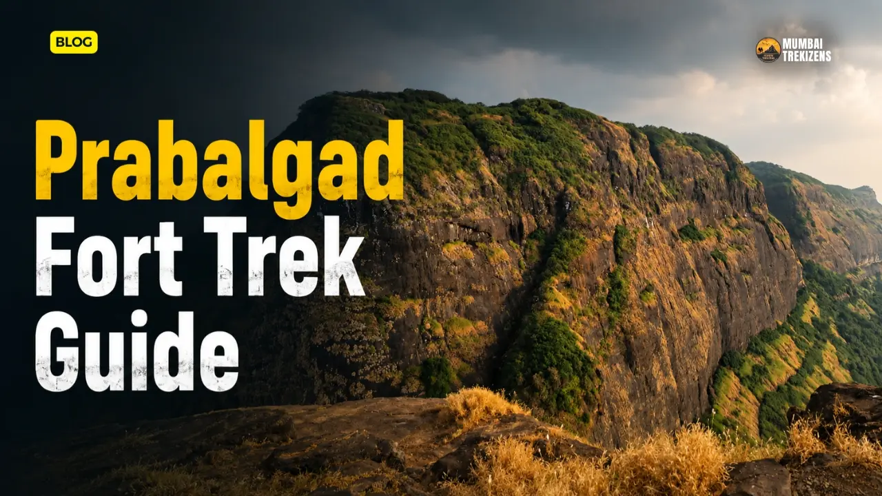
That big one is Prabalgad, and the Prabalgad fort trek is one of the most underrated day-and-a-half outings in Raigad district. The pinnacle gets the Instagram traffic. Prabalgad gets the actual fort: eleven bastions, four dressed-stone granaries still standing, a Ganesh temple, rock-cut cisterns, two ruined gateways and a summit plateau shaped roughly like a Y, all at around 700 metres above sea level, per Wikipedia's geographic entry on the fort.
It was called Muranjan before the Marathas took it. Shivaji Maharaj's forces renamed it Prabalgad after capturing it in 1657. And here is the strange part for a fort this close to Mumbai: on a weekday you can walk the summit for three hours and see nobody.
This guide covers the Shedung turn, the Thakurwadi approach, the Prabalmachi hamlet, the col crossing, the summit circuit, what it costs, and exactly when you should not go.
Table of Contents
- Quick Overview
- Where Prabalgad Is, and What Makes It Different
- History: From Muranjan to Prabalgad
- The Trek Route in Detail
- Difficulty Level and Who Should Attempt It
- How to Reach Prabalgad
- Suggested Itineraries
- Accommodation at Prabalmachi
- Food and Water
- Combining Prabalgad With Kalavantin Durg
- Nearby Attractions
- Budget Breakdown
- Practical Tips
- Safety Tips
- Common Mistakes
- Best Time to Visit
- Frequently Asked Questions
- Conclusion and Call-to-Action
Quick Overview
| Detail | Information |
|---|---|
| Location | Prabal plateau, between Matheran and Panvel, Panvel taluka, Raigad district |
| Height | Approximately 700 m (2,300 ft) above sea level; Durgbharari records the Balekilla at 2,460 ft |
| Base village | Thakurwadi, roughly 14 km from Panvel, reached via the Shedung turn on the old Mumbai-Pune highway |
| Intermediate stop | Prabalmachi hamlet, on the plateau |
| Distance from Mumbai | Approximately 60-70 km to Thakurwadi depending on your starting suburb |
| Distance from Pune | Approximately 110-120 km |
| Trek time | About 1.5 hours base to Prabalmachi; add roughly 1.5-2 hours onward to the summit gateway and back |
| Difficulty | Moderate. Graded "medium" by Durgbharari |
| Best season | October to February |
| Permits | No ticketed permit for the fort. Local guide, rope and village charges are collected informally on the plateau |
| Water on route | Cisterns exist on the summit; only some are potable. Carry your own |
Two things in that table deserve a flag. First, the height figures differ between sources because they are measuring different things: the plateau and machi sit lower than the Balekilla ridge. Second, "no permit" does not mean "no cost" — read the budget section.
Where Prabalgad Is, and What Makes It Different
Prabalgad sits on the Prabal plateau, squarely between Matheran and Panvel, inside Raigad district. The Ulhas river runs east of the fort, the Gadhi river west, and the Patalganga to the south. Chanderi and Peb lie to the west, Manikgad south, Karnala north.
What makes it different from the usual Panvel-area trek is scale. This is not a summit you touch and photograph. Durgbharari's survey puts roughly 3.5 km between the main gate and Kala Buruj alone. The top is thickly forested, which means ruins are hidden rather than displayed, and you find them by walking deliberately rather than by following a crowd.
The fort divides into two parts. The Machi, the broad lower plateau where Prabalmachi village sits and where the Kalavantin pinnacle rises. And the Balekilla, the citadel above, shaped like a Y with three arms: Kalavantin at one end, Kala Buruj at another, Bori Sond at the third.
If you have done Peb Fort on the Matheran side, you are looking across at the same range from the opposite face.
History: From Muranjan to Prabalgad
The fort's older name was Muranjan. Rock-cut caves on the plateau suggest occupation going back to the Satavahana period, and it later served military purposes under the Shilahara and Yadava dynasties. Wikipedia's account notes construction attributed to the Bahmani Sultanate, built to watch over Panvel and Kalyan in North Konkan, with Malik Ahmad taking the fort around 1458 CE during the Konkan conquest.
Then a domestic detail worth knowing. After the Ahmadnagar Sultanate collapsed, Shahaji moved to Muranjan along with Jijabai and the young Shivaji for a brief period. Durgbharari dates that retreat to the pressure of June 1635, when Mughal and Adilshahi forces closed in and Shahaji, refused shelter by the Siddi of Janjira and the Portuguese at Chaul, fell back to Kondhana and Muranjan before moving on to Mahuli. The 1636 Treaty of Mahuli handed North Konkan to the Mughals.
Shivaji's commander Abaji Mahadev retook the region in 1656-57 and Muranjan became Prabalgad. Wikipedia records the capture from the Mughals in 1657, with the fort under a Mughal sardar named Kesar Singh — the only fort in that campaign to put up serious resistance. Singh died in the battle in October 1657. His mother had hidden herself and her grandchild during the attack, and Shivaji ordered them safe passage out.
Prabalgad was among the 23 forts ceded to the Mughals in the 1665 Treaty of Purandar. During Shivaji's reign, Abaji Mahadev governed North Konkan from here.
One more layer, and a good one. In the late 1820s the Ramoshi rebel Umaji Naik and his followers used Prabalgad as a base against the British, issuing a proclamation urging locals to stop paying British taxes. Durgbharari dates the proclamation to 25 December 1827 and the Konkan entry of around 300 men to 1828; Wikipedia gives 1826 for Naik's association with the fort. The dates vary. The fact of the shelter does not.
A last curiosity: the British considered Prabalgad before Matheran as a hill station, and rejected it over water scarcity. Lime mounds and dressed stone brought up for that abandoned project are still lying near Kala Buruj.
The Trek Route in Detail
Stage 1 — Thakurwadi to the ruined bastion
You start walking from Thakurwadi. The trail was once a Forest Department dirt road, wide enough that jeeps ran up to a point just short of the hamlet until 2006, when floods washed much of it out. It was never repaired. What you walk now is a footpath on that old roadbed, which is why the first stretch feels graded and easy compared to a normal Sahyadri approach.
About 45 minutes up you reach a ruined bastion with a few steps and a platform. Rock-carved Ganesh and Hanuman idols sit nearby. This is where the first gate of the fort is believed to have stood. It used to be a clear, obvious landmark. It is now partly hidden behind a built-up eatery.
Stage 2 — Onto the Machi and into Prabalmachi
Past the bastion you are on the Machi. Keep the Kalavantin pinnacle in view and it is roughly a 15-minute walk to Prabalmachi village. Total from base: about one and a half hours. Around 20 to 25 houses sit up here. A ruined Shiva temple stands on the right side of the plateau.
Most trekkers stop here. That is a mistake if the fort is what you came for.
Stage 3 — The col
From the village, the route to the Balekilla runs through the col between Prabalgad and the Kalavantin pinnacle. The path to the col is steep and tiring. Be honest about that. It is the section where a lot of groups quietly decide the pinnacle photo is enough.
Along the col, below Prabalgad, there is a man-made cave about 25 feet deep cut into rock, with an L-shaped turn opening into a chamber roughly 15 by 20 feet. A weathered Hanuman carving sits nearby. Keep going and the path drops into a gorge below the Balekilla, where a second rock-cut cave faces the pinnacle.
Stage 4 — The gorge climb and the main gate
From the gorge it is about a half-hour climb to the fort's ruined main entrance. Locals call this stretch the Bull's Horn Path. The gateway frame is barely standing and carved stones lie scattered around it. The fortification here is wide but mostly buried under soil.
Stage 5 — The summit circuit
This is where the day gets long, and worth it. Working from the main gate:
- The granaries. Four intact dressed-stone buildings on plinths about six feet high, each with a four-foot doorway carved with detail and small light windows. People call them a palace. They are granaries, and by their design likely Bahmani-period.
- The dam and Samadhi. A silted stone dam on a stream below the granaries, and a stone platform believed to be a Samadhi, now overgrown.
- Ganesh Temple. A Ganesh idol with two Nandi idols, one inside and one out. Behind the idol is a triple-tiered Shivling on a sacred base — the detail Durgbharari reads as pushing the site's history back to around the 11th century.
- Bori Sond. About 20 minutes on the right fork, named for the Bori trees on the ridge. Views over Prabalmachi, Panvel city, Karnala and Manikgad.
- The Irshalgad Gate. From the trail toward Kala Buruj, a faint path drops around 200 feet to a ruined gate facing Irshalgad. Arch collapsed, frame standing.
- Kala Buruj. A bastion on the cliff edge, roughly 3.5 km from the main gate, with two rock-cut cisterns nearby, one potable. This is where the abandoned British lime mounds are. Views to Matheran's points, Sondai, Irshalgad and Morbe Dam.
- Sondyechi Sond. The bastion facing Kalavantin, with sightlines to the pinnacle, Chanderi, Peb and parts of Navi Mumbai.
Eleven bastions in total, two ruined gates. To see all of it properly you need most of a day on the top, not two hours.
Difficulty Level and Who Should Attempt It
Moderate. Graded medium by Durgbharari, and that grade is fair, but the difficulty is not evenly distributed.
- Base to Prabalmachi: easy to moderate. A reasonably fit first-timer will manage it. Old road surface, steady gradient, shade for most of it.
- Prabalmachi to the col: the honest hard part. Steep, loose in places, tiring in heat.
- Gorge to main gate: short but requires hands and attention.
- Summit navigation: the real challenge. Dense forest, faint forks, ruins that do not announce themselves. Durgbharari notes that even local guides are unfamiliar with the routes down the fort's descending ridges.
Prabalgad suits a trekker who has done two or three Sahyadri forts and wants a bigger, quieter, more exploratory day. It does not suit someone who wants a clear staircase and a summit selfie in ninety minutes.
Complete beginners: do the Prabalmachi overnight, then the summit the next morning with someone who has been up before. If you are still building basic trek fitness and kit sense, start with the Sahyadri trekking safety checklist for beginners.
How to Reach Prabalgad
From Mumbai
Take a Harbour or Trans-Harbour local to Panvel. It is the anchor point for everything in this area. From Panvel, the base village Thakurwadi is roughly 14 km. Road access is via the Shedung turn on the old Mumbai-Pune highway — this is the turn people miss, so set it in your maps before you leave signal.
From Panvel your options: - Six-seater rickshaw from Panvel to Thakurwadi. This is the standard, most reliable choice. Share it. - ST bus. A Panvel-Thakurwadi service exists but Durgbharari is blunt that it is not very convenient. Frequencies are thin and do not suit an early start. - Own car or cab. Park at Thakurwadi. Ask a villager where, do not block the lane.
Total Mumbai to Thakurwadi: budget 2.5 to 3 hours door to door on a Saturday morning, more if you leave after 7 am.
From Pune
Drive toward Khopoli and Panvel on the expressway, exit for the old highway, take the Shedung turn. Roughly 110-120 km and 2.5 to 3 hours by car. By public transport it is Pune to Panvel by bus or train, then the rickshaw, which pushes the day to 4 hours each way. If you are Pune-based and want a shorter outing, the options in our one-day treks near Pune roundup make more sense mid-week.
From Navi Mumbai
You have the shortest run of anyone. Kharghar or Panvel to Thakurwadi is well under an hour by road.
Mobile network: patchy on the Machi, unreliable to absent in the gorge and on the wooded summit. Screenshot your route. Do not rely on live maps above the col.
Suggested Itineraries
Option A — Overnight at Prabalmachi, summit on day two (recommended)
Day 1 - Afternoon: reach Panvel, rickshaw to Thakurwadi, start walking by 4 pm. - 5:30 pm: reach Prabalmachi. Check into a homestay or set up a tent. - Evening: sunset from the plateau edge, dinner in the village.
Day 2 - 6:00 am: start early for the col. - 7:30 am: main gate of the Balekilla. - 8:00 am to 12:30 pm: the summit circuit. Granaries, Ganesh temple, Bori Sond, Kala Buruj, Sondyechi Sond. - 1:30 pm: back down to Prabalmachi, lunch. - 3:30 pm: Thakurwadi. Rickshaw out.
This is the version that actually lets you see the fort.
Option B — Long single day
- 5:30 am: leave Mumbai.
- 8:00 am: start from Thakurwadi.
- 9:30 am: Prabalmachi.
- 11:00 am: main gate.
- 11:00 am to 2:00 pm: partial summit circuit. Pick two of Bori Sond, Kala Buruj, Sondyechi Sond. You cannot do all three and get down comfortably.
- 4:30 pm: Thakurwadi.
Doable October to February. Do not attempt this in April or May.
Accommodation at Prabalmachi
Prabalmachi has homestays and tented camping run by families in the hamlet. Around 20 to 25 houses sit on the plateau and several take guests. Expect simple: mattress on a floor or a tent, shared washing arrangements, dinner and morning tea included in most packages.
Book by phone in advance on long weekends. The plateau fills up, mostly with Kalavantin traffic.
A caveat that Durgbharari puts bluntly and that matches what the site now feels like: proximity to Mumbai has commercialised Prabalmachi, and the hospitality has become more transactional than it once was. Fixed rates for water, sherbet, rope assistance. Agree numbers before, not after.
The Balekilla itself has no shelter. There is no wada, no temple hall, nothing roofed. If you are planning a night on the actual fort, you are camping wild with no water certainty, and that is a different trip requiring a different level of self-sufficiency.
Food and Water
The eatery near the ruined bastion 45 minutes up, plus stalls and homestay kitchens in Prabalmachi, cover the base and Machi. Poha, vada pav, thali-style dal-rice-bhaji, tea, kokum sherbet, lime water. Prices are hill prices. Fine.
Above the col, nothing. Zero.
On water: the fort has multiple rock-cut cisterns and their quality varies badly. Durgbharari's survey records the cistern on the col below the pinnacle as potable but hard to reach, one near the main gate as not drinkable, the Bori Sond cistern as not drinkable, and one of the two near Kala Buruj as potable. Do not use that as a plan. Use it as an emergency backup.
Carry 3 litres per person minimum for the summit day. Four in warm weather. There is no refill point above Prabalmachi you can rely on.
Combining Prabalgad With Kalavantin Durg
They share a base, a hamlet and a col, so combining them is natural and most groups do.
Kalavantin Durg is the 685 m pinnacle on the northern edge of the Prabal plateau, famous for the railing-less rock-cut steps carved straight up its face. It is, technically, part of the Prabalgad upper fort — the pinnacle and the citadel both sit on the same Machi.
We have written that climb up separately, because it deserves its own treatment and its own warnings: see the Kalavantin Durg trek guide for the steps, the descent problem and the conditions in which you should not go anywhere near them.
For sequencing: if you are doing both over an overnight, do Kalavantin at first light and Prabalgad after. The pinnacle steps get crowded and hot; the fort does not. Doing both in one day from Mumbai is a bad plan that people attempt anyway. Something gets rushed, and on Kalavantin the thing that gets rushed is the descent.
Nearby Attractions
- Matheran. The plateau looks straight across at it. Reachable separately via Neral and the toy train.
- Karnala Fort and Bird Sanctuary. North of Prabalgad, an easy half-day and a completely different kind of outing. Details in our Karnala Fort trek guide.
- Peb Fort (Vikatgad). West of Prabalgad, on the Matheran side. See the Peb Fort trek guide.
- Irshalgad. Prabalgad's sister fort, visible from Kala Buruj, with a ruined gate on Prabalgad facing it. Note that the villages below Irshalgad were hit by a major landslide and access conditions there have changed. Check the current situation locally before planning anything on that side.
- Morbe Dam. Visible from Kala Buruj, a pleasant drive from Panvel.
Budget Breakdown
Per person, two people sharing, from Mumbai. Overnight version.
| Item | Cost (INR) |
|---|---|
| Mumbai to Panvel local train (return) | 40 - 80 |
| Panvel to Thakurwadi six-seater rickshaw (return, shared) | 150 - 250 |
| Prabalmachi homestay or tent, one night with dinner and breakfast | 500 - 900 |
| Lunch on the Machi | 120 - 200 |
| Tea, sherbet, packaged water on route | 100 - 200 |
| Local guide for the Balekilla (shared between group) | 300 - 700 per group |
| Buffer for village and rope charges | 100 - 200 |
| Total per head, DIY overnight | approximately 1,100 - 1,900 |
Single-day DIY from Mumbai without the stay: roughly 500 to 900 per head.
Organised group departures with transport, camping and a leader typically run higher than DIY. That premium buys you the summit navigation, which on Prabalgad is genuinely worth paying for the first time.
Carry cash. UPI works patchily at Thakurwadi and is unreliable on the plateau.
Practical Tips
- Set the Shedung turn in your map before Panvel. It is the single most-missed navigation point on this trek.
- Start from Thakurwadi by 8 am on a single-day attempt. Earlier if it is March or later.
- Hire a Prabalmachi guide for the summit on a first visit. Not for the walking. For the forks. Agree the fee and the exact points you want to see before you set off, because guides here tend to shorten the circuit if you let them.
- Weekdays are dramatically better. Durgbharari's own recommendation is to avoid weekends and holidays entirely if you want the fort's quiet. That is accurate.
- Grippy footwear matters on the col and the gorge climb — see our trekking footwear guide for Sahyadri terrain if you are buying.
- Carry a headtorch even on a day trek. Summit navigation eats time faster than you expect.
- Pack out everything. The Machi already has a litter problem from weekend volume.
- Do not count on the cisterns.
Safety Tips
- Monkeys and langurs are present and habituated on the lower trail. Do not eat where they can see you, do not feed them, keep your bag zipped. Broader guidance is in our wildlife safety on Sahyadri treks article.
- The col path is the injury zone. Steep and loose. Descend it with control, not momentum.
- Beehives exist on the cliff faces in this range. If you hear a rising hum, back off downhill quietly. Do not swat, do not run uphill.
- Never split from your group on the summit. The forest cover means someone thirty metres off the trail is genuinely lost, and there is no phone signal to fix it.
- Take the Raigad district monsoon orders seriously. The district administration has repeatedly imposed prohibitory orders under the Disaster Management Act and Section 163 of the BNSS restricting entry to specific forts, waterfalls and dam areas during peak rainfall, with the Kalavantin approach explicitly restricted in recent seasons. These orders change year to year. Check raigad.gov.in for the current notification before a monsoon trip. Fines and criminal penalties apply.
- Turn back rather than push. Read our monsoon trekking safety guide for the Sahyadri before any June to September attempt in this range.
- Carry a real first aid kit, not a strip of paracetamol. Ours is listed in the first aid kit for Sahyadri treks guide.
Common Mistakes
- Stopping at Prabalmachi and calling it Prabalgad. Most "Prabalgad trek" reports online never crossed the col. The fort is above it.
- Allowing two hours for the summit. You need five or six to do the circuit justice.
- Doing Kalavantin and the full fort in one day from Mumbai. Something gets cut, and it is usually safety margin.
- Trusting the cisterns for water.
- Attempting the col and gorge in heavy monsoon without checking district orders.
- Not agreeing guide and rope charges upfront.
- Going on a long weekend and then complaining it was crowded.
Best Time to Visit
October to February. Clear position, no hedging.
- October to November: the best window overall. Everything is still green from the rain, the streams have water, the rock is dry, and the temperature is manageable. Post-Diwali weekdays are ideal.
- December to February: cool mornings, excellent visibility, dry footing on the col and gorge. Best for a summit-heavy day.
- March: acceptable if you start at first light and carry four litres. The plateau has almost no shade in the open sections.
- April and May: skip it. The Machi bakes, there is no reliable water above Prabalmachi, and the exposed summit sections in afternoon heat are miserable and genuinely risky. Wikipedia's climate table for Prabalgad shows April and May mean daily maximums around 32.8°C and 32.9°C. That is on the plateau, in the open.
- June to September: the range is spectacular and the col is dangerous. Heavy monsoon rainfall here concentrates in July and August. Prabalmachi in the rain is lovely and worth it on its own. The Balekilla circuit in the rain, with faint forest trails and no signal, is not worth it. Also check district prohibitory orders, which have restricted access in this area during peak monsoon.
Frequently Asked Questions
1. How high is Prabalgad fort? Approximately 700 metres, or 2,300 feet, above sea level according to Wikipedia. Durgbharari records the Balekilla, the citadel ridge, at 2,460 feet. The difference reflects the fort's two levels — the Machi plateau sits lower than the citadel.
2. How long does the Prabalgad fort trek take? About one and a half hours from Thakurwadi to Prabalmachi village. From there, roughly half an hour to the col plus another half hour up the gorge to the fort's main gate. The summit circuit itself needs four to six hours if you want to see the granaries, Ganesh temple, Bori Sond and Kala Buruj. Plan a full day, or better, an overnight.
3. Is Prabalgad fort trek suitable for beginners? The stretch up to Prabalmachi is fine for a fit beginner. The col is steep and tiring, and the summit is a dense forest plateau where navigation, not fitness, is the real difficulty. A beginner should do this with an experienced companion or a local guide, ideally over an overnight rather than in one push.
4. What is the difference between Prabalgad and Kalavantin Durg? Kalavantin Durg is the 685-metre pinnacle on the northern edge of the same Prabal plateau, famous for its exposed rock-cut steps. Prabalgad is the much larger fort beside it, with eleven bastions, granaries, temples and cisterns spread across a wooded summit plateau. Technically the pinnacle sits on Prabalgad's Machi, so Kalavantin is part of the same fort complex.
5. How do I reach Thakurwadi from Panvel? Thakurwadi is roughly 14 km from Panvel, reached by taking the Shedung turn off the old Mumbai-Pune highway. Six-seater shared rickshaws from Panvel are the practical option. An ST bus service exists between Panvel and Thakurwadi but is infrequent and awkward for an early start.
6. Is there an entry fee for Prabalgad? There is no ticketed government entry fee for the fort itself. In practice you will pay for shared transport, food, homestay or camping at Prabalmachi, a local guide if you take one, and rope assistance if you use it on the Kalavantin steps. Carry cash.
7. Can you stay overnight on Prabalgad fort? There is no roofed shelter on the Balekilla — no wada, no temple hall. Overnight stays happen at Prabalmachi hamlet on the plateau below, where homestays and tented camping are available. Camping on the citadel itself means full self-sufficiency including all water.
8. Is Prabalgad safe during monsoon? The lower trail to Prabalmachi is manageable in moderate rain. The col and the gorge climb to the main gate are not, and the summit forest with no mobile signal compounds the risk. Raigad district has also imposed prohibitory orders restricting entry to specific forts and waterfalls during peak rainfall in recent years. Check the current district notification before going.
Prabalgad is the fort people drive past to reach the pinnacle. That is a genuine loss, because the actual fort is the more interesting object — bigger, quieter, older, with granaries still standing after five hundred years and a summit you have to earn by walking rather than posing.
Go in November or December. Go on a weekday. Cross the col. Take a guide the first time, carry three litres, and give yourself the full day on top instead of two hurried hours. Then come back and do Kalavantin at sunrise on a separate trip, when you can give the steps the attention they demand.
Ready for Your Next Adventure?
Don't just read about it — come experience it. Book your spot on the Prabalgad Monsoon Trek with certified trek leaders, small groups, and everything organised for you.
🏷 - Prabalgad trek from Panvel, - Thakurwadi Prabalmachi route, - Prabalgad fort height, - Muranjan fort Raigad, - Prabalgad Kalavantin combined trek, - how to reach Prabalgad fort from Mumbai by train and bus, - Prabalgad fort trek difficulty for beginners, - Prabalmachi camping cost per person, - Prabalgad fort trek in monsoon safe or not, - Prabalgad fort trek total time from Thakurwadi
Be the first to comment on this post.