Introduction
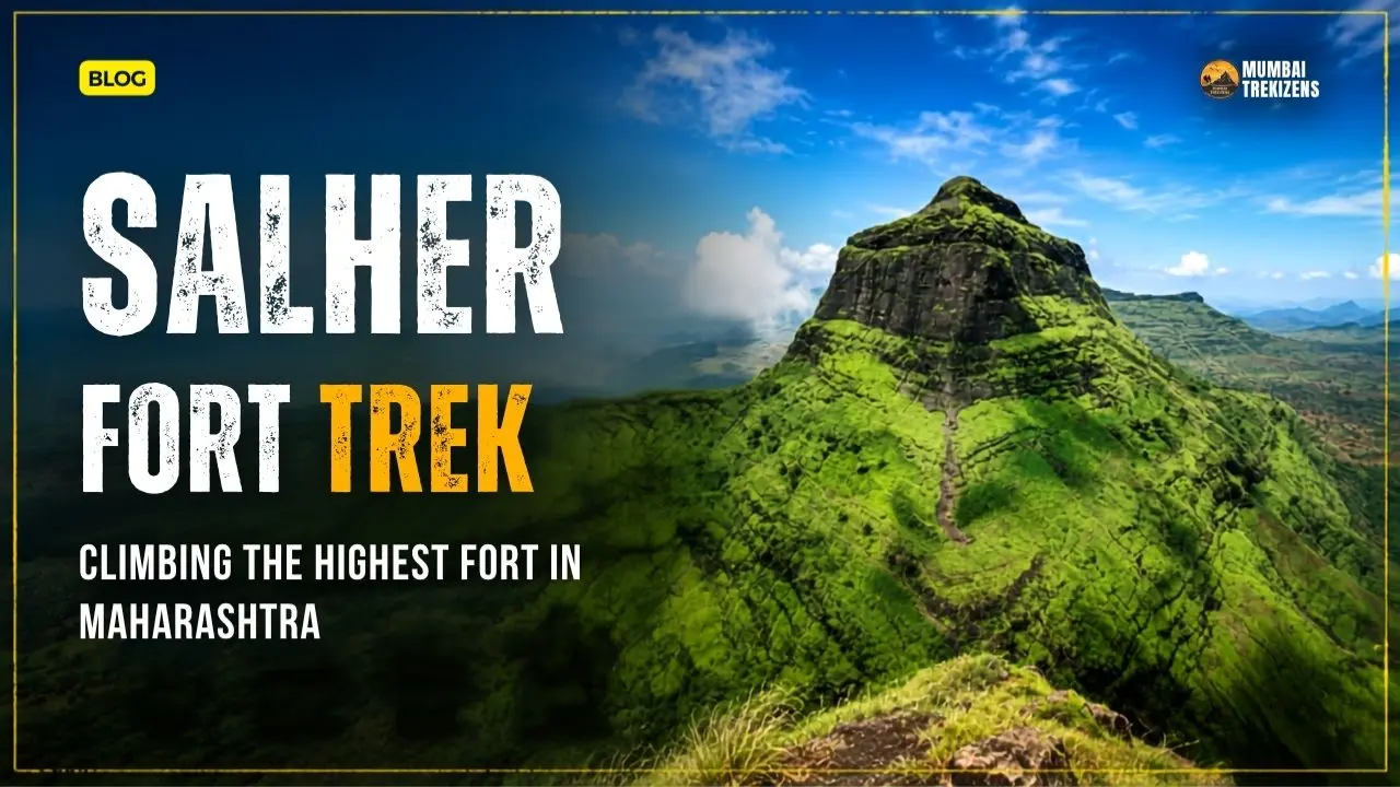
If Kalsubai is the highest peak in Maharashtra, then Salher holds an equally proud title: the highest fort in the state. The Salher fort trek takes you to 5,141 feet, through Renuka Devi and Ganesh temples, past a serene hilltop lake, to a summit steeped in Maratha glory and blessed with endless Sahyadri views.
Set in the remote Selbari range of the Baglan region in Nashik district, Salher is a trek that combines real elevation, genuine history, and a peaceful, off-the-beaten-path feel. This is where Chhatrapati Shivaji Maharaj's forces won a famous open battle against the Mughals in 1671.
This guide covers the routes from Salherwadi and Waghambe, difficulty, trekking time, water, stay, transport, and the nearby forts of Salota and Mulher that make this a superb multi-fort trekking region.
Table of Contents
- Where Salher Is Located
- The History and the Great Battle
- What's on the Fort
- Trek Routes: Salherwadi vs Waghambe
- Difficulty Level and Who It Suits
- Salher, Salota, and Mulher: The Range
- How to Reach Salher
- Best Time to Visit
- Water, Food, and Stay
- Safety Tips
- Practical Tips
- Common Mistakes
- Expert Insights
- Frequently Asked Questions
- Ready for Your Next Adventure?
Where Salher Is Located
Salher Fort stands in the Selbari mountain range of the Baglan region, in Nashik district, Maharashtra, at a height of 5,141 feet. It is the highest fort in Maharashtra and the second-highest peak in the state after Kalsubai, ranking among the highest points in the entire Western Ghats.
The fort sits near two base villages, Salherwadi and Waghambe, in a remote, rural stretch of northern Maharashtra close to the Gujarat border. Its neighbors, Salota and Mulher forts, are part of the same range.
Because of its height and remoteness, Salher offers vast, uninterrupted views and a genuine sense of wilderness, rewarding those willing to travel to reach it. Salher sits in a remote corner of the range, which makes emergency planning for remote Sahyadri treks especially important.
The History and the Great Battle
Salher's history is proud and dramatic. The fort is best known as the site of the Battle of Salher in 1671, described as one of the fiercest and largest open-field battles between the Mughals and the Marathas, and a famous victory for Chhatrapati Shivaji Maharaj's forces.
Unlike many hill-fort skirmishes, this was a major open battle, and the Maratha win here was a significant boost to the growing Swarajya. Standing on Salher's heights, knowing this history, adds real weight to the climb.
The fort's long strategic importance came from its commanding height over the Baglan region and the routes toward Gujarat. Its old gateways, structures, and water systems still speak of that significance today.
What's on the Fort
Salher's expansive summit and slopes hold several notable features:
- The Renuka Devi temple, an open shrine revered by locals and trekkers.
- A Ganesha temple on the fort.
- Gangasagar lake, a hilltop water body that's both scenic and a traditional water source.
- The fort's highest point, offering breathtaking 360-degree views across the Selbari range and beyond.
- Old gateways, fortifications, and caves from the fort's active days.
Reaching the Renuka Devi shrine and the peaceful Gangasagar lake near the top, then climbing to the very highest point, gives the trek a rewarding sense of arrival. On a clear day, the views from the highest fort in Maharashtra are simply unforgettable.
Trek Routes: Salherwadi vs Waghambe
There are two main routes up Salher, from two different base villages.
Waghambe Route (shorter, common)
- The trek from Waghambe to the top is about 4 km, taking roughly 2 to 3 hours.
- Generally the more commonly used and slightly more direct approach.
- Still steep in its upper sections, with rock patches.
Salherwadi Route (longer, tougher)
- The route from Salherwadi is longer and tougher than the Waghambe approach.
- Rewards with its own scenery and a more gradual build in places.
| Feature | Waghambe Route | Salherwadi Route |
|---|---|---|
| Length | Shorter (~4 km) | Longer |
| Difficulty | Moderate, steep upper | Tougher, longer |
| Time | ~2-3 hours | Longer |
| Best for | Most trekkers | Those wanting a longer route |
A popular approach for multi-fort trekkers is to combine the villages and forts, ascending one way and exploring the range, sometimes linking Salher with neighboring Salota. Whichever route you choose, the final ascent is steep and rocky, so care is needed near the top.
Difficulty Level and Who It Suits
The Salher fort trek is rated moderate to challenging. The height, the steep upper rocky sections, and the remoteness all add up.
- Suitable for: trekkers with good fitness and some experience; the ascent's steep, rocky patches need care.
- Needs care: the very steep upper climb over rocky patches, and the remote setting far from quick help.
- Less ideal for: absolute beginners going independently, given the height and remoteness.
While the Waghambe route is relatively short at around 4 km, the steep final section makes it demanding, and reaching the highest fort in Maharashtra is a genuine achievement. Given the remoteness and elevation, this is a trek where going with an experienced group adds both safety and smooth logistics.
Salher, Salota, and Mulher: The Range
Salher doesn't stand alone. It's part of a cluster of forts in the Selbari-Dolbari ranges, making the area a fantastic multi-fort trekking region.
- Salota Fort: Salher's close neighbor, often combined with Salher in a single trip for those wanting to bag two summits.
- Mulher Fort: Another significant fort in the region, along with Mora and Hargad, forming a classic multi-fort circuit.
- The range trek: Experienced, fit trekkers sometimes link several of these forts over one or two days for a rich, immersive experience.
For most trekkers, Salher (often with Salota) is the main objective, while adding Mulher and others is a bigger undertaking for well-prepared groups. This cluster is exactly the kind of remote, rewarding region where a guided multi-fort trek shines, handling the navigation, timing, and logistics across a rural, less-developed area.
How to Reach Salher
By Train
- Manmad is a useful railway hub for reaching the Baglan region. From there, travel by road toward Satana (Baglan) and onward to the base villages of Salherwadi or Waghambe.
From Mumbai / Nashik
- Reach Nashik or Manmad, then drive toward the Baglan/Satana area and the base villages. Salher is in a remote corner of Nashik district, so plan for a longer road journey (often several hours from Nashik).
From Pune
- A longer trip via Nashik and onward to Baglan; many trekkers make it an overnight or two-day plan given the distance.
Note: Salher is genuinely remote, and public transport to the base villages is limited. Most trekkers arrange private vehicles or go with an organized group. Because of the distance, it's commonly done as an overnight or weekend trip rather than a quick day outing. Confirm all transport in advance.
Best Time to Visit
- Post-monsoon (October to November): Excellent, with lush green slopes, pleasant weather, and good visibility for the vast views. Water sources are still full.
- Winter (December to February): Cool, clear, and comfortable, ideal for the climb and the far-reaching vistas.
- Monsoon (June to September): Beautifully green and dramatic, but the steep upper rock gets slippery and the remote area can be harder to access. Extra caution and experienced support are important.
- Summer (March to May): Hot and exposed on the high, open fort; water can be scarce, so start very early and carry plenty.
For the best mix of views, greenery, and safe footing, aim for post-monsoon and winter (October to February).
Water, Food, and Stay
Water: The fort has Gangasagar lake and traditional water sources near the top, but reliability varies by season. Carry enough of your own water (2 to 3 liters minimum), and treat any fort water before drinking.
Food: The base villages of Salherwadi and Waghambe are small and rural, with limited facilities. Some basic food may be arranged through villagers or homestays, but carry your own trail food and snacks. Don't expect stalls on the fort.
Stay options:
- Basic homestays in the base villages, simple and rural.
- Camping near the base or on the fort area for well-prepared groups.
- Given the remoteness, staying overnight is common and helps manage the long travel.
Because this is a remote, less-developed region, come fully self-sufficient. Organized treks typically arrange food and stay with local villagers, which smooths the experience considerably.
Safety Tips
- Wear trekking shoes with strong grip for the steep, rocky upper climb.
- Take the steep final section carefully, using hands where needed.
- Carry 2 to 3 liters of water and treat any fort water before drinking.
- Plan for the remoteness: carry a first aid kit, know your route, and keep emergency contacts.
- Start early to complete the climb and descent in good light.
- Check the weather and be cautious on the exposed high fort in thunderstorms.
- Go with an experienced group given the height, remoteness, and multi-fort options.
- Carry out all trash to protect this remote heritage site.
The combination of high elevation, steep rock, and remoteness means self-sufficiency and, ideally, experienced guidance are key here, more so than on popular, easily accessed forts. On a long, exposed climb like this, knowing when to cancel or turn back is a vital skill.
Practical Tips
- Plan an overnight or weekend trip given the long travel to the Baglan region.
- Combine Salher with Salota for a two-summit trip if fit.
- Carry ample water, as sources are seasonal on the high fort.
- Carry cash; the rural base villages have minimal facilities.
- Grippy shoes are essential for the steep upper rock.
- Arrange transport and stay in advance in this remote area.
- Respect the temples (Renuka Devi, Ganesha) on the fort.
- Leave no trace in this pristine, less-visited region.
Common Mistakes
- Underestimating the travel distance to the remote Baglan region.
- Treating it as a casual day trip rather than a well-planned overnight.
- Carrying too little water for the high, exposed fort.
- Attempting the steep upper rock in worn shoes.
- Going unprepared into a remote area without a plan or contacts.
- Ignoring the weather on the exposed highest fort.
- Skipping experienced guidance despite the height and remoteness.
- Littering at a remote, unspoiled heritage site.
Expert Insights
Trek leaders regard Salher as a bucket-list trek for serious Sahyadri lovers. Standing on the highest fort in Maharashtra, at the site of a famous Maratha victory, with the Selbari range rolling out in every direction, is a genuinely special experience that rewards the effort of reaching this remote corner.
They stress that the remoteness is the real planning challenge. Salher isn't a quick day trip from the city; it's a well-planned overnight or weekend expedition to a rural region with limited transport and facilities. This is exactly where an organized trek adds enormous value, handling the long logistics, the base-village stay, and food that would otherwise be tricky to arrange.
Their favorite recommendation is to make the most of the range. Combining Salher with neighboring Salota, or even the wider Mulher-Mora-Hargad circuit for the very fit and experienced, turns a single climb into an unforgettable multi-fort adventure. Done with a knowledgeable team, it's one of the richest trekking experiences northern Maharashtra offers.
Frequently Asked Questions
1. What is the highest fort in Maharashtra? Salher Fort, at 5,141 feet in the Selbari range of Nashik district, is the highest fort in Maharashtra. It's also the second-highest peak in the state after Kalsubai and among the highest in the Western Ghats.
2. How difficult is the Salher fort trek? It's rated moderate to challenging. The Waghambe route is about 4 km and takes 2 to 3 hours, but the steep, rocky upper section and the fort's remoteness make it demanding. Good fitness and care are needed.
3. Which route is best for the Salher fort trek? The Waghambe route is shorter (about 4 km) and more commonly used, while the Salherwadi route is longer and tougher. Both finish with a steep, rocky ascent, so choose based on your fitness and time.
4. What is the history of Salher fort? Salher is famous for the Battle of Salher in 1671, one of the fiercest large open battles between the Mughals and the Marathas, won by Chhatrapati Shivaji Maharaj's forces, a major boost to the Maratha Swarajya.
5. How do I reach Salher fort? Reach Nashik or Manmad, then travel by road toward the Baglan/Satana area and the base villages of Salherwadi or Waghambe. It's remote, so plan a longer journey and arrange private transport or an organized trek.
6. What is the best time for the Salher fort trek? Post-monsoon and winter (October to February) are best, with green slopes, clear views, and safer footing. Monsoon is dramatic but slippery, and summer is hot and exposed with scarce water.
7. Can I combine Salher with other forts? Yes. Salher is often combined with neighboring Salota, and fit, experienced trekkers sometimes link Mulher, Mora, and Hargad into a multi-fort circuit, best done with an organized group given the remoteness.
The Salher fort trek is a proud climb to the highest fort in Maharashtra: 5,141 feet of history, temples, a hilltop lake, and vast Sahyadri views, crowned by the memory of a famous Maratha victory. Its remote Baglan setting makes it a genuine expedition, rewarding those willing to travel far off the usual trekking map.
Plan it as an overnight or weekend trip, carry ample water, take the steep upper rock with care, and consider combining it with Salota for a two-summit adventure. With good preparation and experienced support, Salher delivers one of the most memorable and rewarding treks in all of Maharashtra.
Ready for Your Next Adventure?
Don't just read about it — come experience it. Book your spot on Sahyadri Treks with certified trek leaders, small groups, and everything organised for you.
🏷 highest fort in Maharashtra, Salher Waghambe route, Salherwadi village trek, Salher Salota fort, Mulher fort nearby, Salher fort trek route and difficulty
Be the first to comment on this post.